
Warren, New Hampshire
Warren, New Hampshire | |
|---|---|
Town | |
 Redstone missile on the Common | |
 Location in Grafton County, New Hampshire | |
| Coordinates: 43°55′29″N 71°53′30″W / 43.92472°N 71.89167°W | |
| Country | United States |
| State | New Hampshire |
| County | Grafton |
| Incorporated | 1763 |
| Villages | Warren Glencliff |
| Government | |
| • Board of Selectmen | Charles Sackett Jr. Charles Chandler Lesa Romano |
| • Town Administrator | Austin Albro |
| Area | |
| • Total | 49.0 sq mi (127.0 km2) |
| • Land | 48.5 sq mi (125.5 km2) |
| • Water | 0.6 sq mi (1.5 km2) 1.18% |
| Elevation | 770 ft (235 m) |
| Population (2010) | |
| • Total | 904 |
| • Density | 18/sq mi (7.1/km2) |
| Time zone | UTC-5 (Eastern) |
| • Summer (DST) | UTC-4 (Eastern) |
| ZIP codes | 03279 (Warren) 03238 (Glencliff) |
| Area code | 603 |
| FIPS code | 33-78740 |
| GNIS feature ID | 0873746 |
| Website | warren-nh |
Warren is a town in Grafton County, New Hampshire, United States. The population was 904 at the 2010 census.[1] Warren includes the village of Glencliff.
It is the smallest by population of the six towns named Warren in New England (one in each state).
History

Warren was granted in 1763 by Governor Benning Wentworth, and incorporated in 1770 by Governor John Wentworth. The town takes its name from Admiral Sir Peter Warren. It was first settled in 1767 by Joseph Patch.[2]
From 1909 until 1970, Glencliff, located in the northern part of Warren, was the mailing address for the New Hampshire State Sanatorium, located just over the town line in Benton, at an elevation of 1,650 feet (500 m) on the slopes of Mount Moosilauke. Before the discovery of antibiotics, pure mountain air was thought to be curative for patients with tuberculosis. With its own farm on 500 acres (200 ha), the facility would treat more than 4,000 individuals over its first half century, admitting between 50 and 100 per year. Many came from the industrial cities of southern New Hampshire such as Concord, Manchester and Nashua. It is now the Glencliff Home.[3]
The town's most famous landmark is a Redstone ballistic missile erected in the center of the village green. It was donated by Henry T. Asselin, who transported the missile from the Redstone Arsenal near Huntsville, Alabama, in 1971, then placed in honor of long-time Senator Norris Cotton, a Warren native.[4]
-
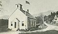
 Church and school c. 1910
 -
 State Sanatorium in 1909
 -
 Summit School in 1915


Geography
According to the United States Census Bureau, the town has a total area of 49.0 square miles (126.9 km2), of which 48.5 square miles (125.6 km2) is land and 0.6 square miles (1.6 km2) is water, comprising 1.18% of the town.[1] Warren is drained by the Baker River. The highest point in Warren is at the southern boundary of the town, on the north ridge of Carr Mountain, where the elevation reaches approximately 3,330 feet (1,010 m) above sea level. Set in the White Mountains, the town is surrounded by the White Mountain National Forest.
Warren is crossed by New Hampshire Route 25 and New Hampshire Route 118.
Demographics
| Census | Pop. | Note | %± |
|---|---|---|---|
| 1790 | 206 | — | |
| 1800 | 336 | 63.1% | |
| 1810 | 506 | 50.6% | |
| 1820 | 544 | 7.5% | |
| 1830 | 702 | 29.0% | |
| 1840 | 938 | 33.6% | |
| 1850 | 872 | −7.0% | |
| 1860 | 1,152 | 32.1% | |
| 1870 | 960 | −16.7% | |
| 1880 | 786 | −18.1% | |
| 1890 | 875 | 11.3% | |
| 1900 | 799 | −8.7% | |
| 1910 | 701 | −12.3% | |
| 1920 | 600 | −14.4% | |
| 1930 | 651 | 8.5% | |
| 1940 | 709 | 8.9% | |
| 1950 | 581 | −18.1% | |
| 1960 | 548 | −5.7% | |
| 1970 | 539 | −1.6% | |
| 1980 | 650 | 20.6% | |
| 1990 | 820 | 26.2% | |
| 2000 | 873 | 6.5% | |
| 2010 | 904 | 3.6% | |
| 2017 (est.) | 916 | [5] | 1.3% |
| U.S. Decennial Census[6] | |||
As of the census of 2010, there were 904 people, 381 households, and 238 families residing in the town. The population density in 2010 was 18.6 people per square mile (7.2/km²). There were 612 housing units at an average density of 12.6 per square mile (4.8/km²). The racial makeup of the town was 96.57% White, 0.22% African American, 0.33% Native American, 0.11% Asian, 0.22% some other race, and 2.43% from two or more races. Hispanic or Latino of any race were 0.55% of the population.[7]
There were 381 households, out of which 27.8% had children under the age of 18 living with them, 52.2% were headed by married couples living together, 8.7% had a female householder with no husband present, and 37.5% were non-families. 28.1% of all households were made up of individuals, and 9.9% were someone living alone who was 65 years of age or older. The average household size was 2.37, and the average family size was 2.92.[1]
In the town, the population was spread out with 20.7% under the age of 18, 6.2% from 18 to 24, 22.8% from 25 to 44, 33.2% from 45 to 64, and 17.1% who were 65 years of age or older. The median age was 45.2 years. For every 100 females, there were 105.9 males. For every 100 females age 18 and over, there were 103.7 males.[1]
The median annual income calculated between 2010-2014 by the Census' American Community Survey for a household in the town was $45,000, and the median income for a family was $52,857. Male full-time workers had a median income of $41,364 versus $36,250 for females. The per capita income for the town was $24,313. About 17.4% of families and 19.3% of the population were below the poverty line, including 32.1% of those under age 18 and 4.7% of those age 65 or over.[8]
See also
Sites of interest
- Davis-White State Forest
- Warren Historical Society Museum
Notable people
- Norris Cotton, US senator and congressman
- Robert "Bob" J. Giuda, airline captain and state congressman
- Joseph Monninger, author[10][11]
References
- ^ a b c d "Geographic Identifiers: 2010 Census Summary File 1 (G001): Warren town, Grafton County, New Hampshire". U.S. Census Bureau, American Factfinder. Retrieved November 8, 2016.
- ^ Austin J. Coolidge & John B. Mansfield, A History and Description of New England; Boston, Massachusetts 1859
- ^ Paige Wickner and Fordham Von Reyn, M.D., Mountain Aerie; History of the New Hampshire State Sanatorium
- ^ Asselin, Ted (1996). The Redstone Missile - Warren, NH (PDF). Warren: Bryan Flagg.
- ^ "Annual Estimates of the Resident Population: April 1, 2010 to July 1, 2017 (PEPANNRES): Minor Civil Divisions – New Hampshire". Retrieved November 14, 2018.
- ^ "Census of Population and Housing". Census.gov. Retrieved June 4, 2016.
- ^ "Profile of General Population and Housing Characteristics: 2010 Census Summary File 1 (DP-1): Warren town, Grafton County, New Hampshire". U.S. Census Bureau, American Factfinder. Retrieved November 8, 2016.
- ^ "Selected Economic Characteristics: 2010-2014 American Community Survey 5-Year Estimates (DP03): Warren town, Grafton County, New Hampshire". U.S. Census Bureau, American Factfinder. Retrieved November 8, 2016.
- ^ "The Johnson County War: 1892 Invasion of Northern Wyoming | WyoHistory.org". www.wyohistory.org. Retrieved 2017-09-14.
- ^ "Joseph Monninger". Simon & Schuster. Retrieved 2017-09-14.
- ^ The Bookshelf: Joseph Monninger on Football and Fighting the Odds | New Hampshire Public Radio Retrieved 2018-08-21.
External links
- Town of Warren official website
- Joseph Patch Library
- Asquamchumauke Valley Snowmobile Club
- Mount Moosilauke ATV Club
- Northcountry News, Warren, NH
- New Hampshire Economic and Labor Market Information Bureau Profile
Places adjacent to Warren, New Hampshire | |
|---|---|
Municipalities and communities of Grafton County, New Hampshire, United States | ||
|---|---|---|
| City |  | |
| Towns |
| |
| Township | ||
| CDPs | ||
| Other villages | ||