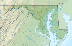
Fishing Bay Wildlife Management Area
Appearance
| Fishing Bay Wildlife Management Area | |
|---|---|
| Location | Dorchester, Maryland, United States |
| Coordinates | 38°19′56″N 75°55′54″W / 38.33222°N 75.93167°W |
| Area | 29,000 acres (120 km2) |
| Operator | Maryland Department of Natural Resources |
| Website | Fishing Bay WMA |
Fishing Bay Wildlife Management Area is a Wildlife Management Area in Dorchester County, Maryland. The area is the largest wildlife management area in Maryland. Adjoining Blackwater National Wildlife Refuge, the area is about 80 percent tidal marshland.[1]
References
[edit]- ^ "Fishing Bay WMA". Maryland Department of Natural Resources. Retrieved 2 May 2018.
External links
[edit]

