Jump to content

Maesycoed

Coordinates: 51°35′58″N 3°21′07″W / 51.599492°N 3.351967°W / 51.599492; -3.351967
From Wikipedia, the free encyclopedia

This is the current revision of this page, as edited by PrimeBOT (talk | contribs) at 23:03, 22 August 2021 (top: Task 30: removal of infobox params following a discussion). The present address (URL) is a permanent link to this version.

(diff) ← Previous revision | Latest revision (diff) | Newer revision → (diff)

Maesycoed
Maesycoed is located in Rhondda Cynon Taf
Maesycoed
Maesycoed
Location within Rhondda Cynon Taf
OS grid referenceST064898
Principal area
Preserved county
CountryWales
Sovereign stateUnited Kingdom
Post townPONTYPRIDD
Postcode districtCF37
Dialling code01443
PoliceSouth Wales
FireSouth Wales
AmbulanceWelsh
UK Parliament
Senedd Cymru – Welsh Parliament
List of places
UK
Wales
Rhondda Cynon Taf
51°35′58″N 3°21′07″W / 51.599492°N 3.351967°W / 51.599492; -3.351967

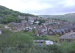
Maesycoed is a settlement to the south and west of Pontypridd town centre in the county borough of Rhondda Cynon Taf, Wales. Maesycoed is a district in the town of Pontypridd within the Rhondda electoral ward and is bounded by Graig to the south, Pwllgwaun to the east and Hopkinstown and Mynydd Gelliwion to the north.