
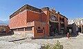
Charang, Nepal
Charang
चाराङ | |
|---|---|
 Charang | |
 Charang Location in Nepal  Charang Charang (Nepal) | |
| Coordinates: 29°5′34″N 83°55′57″E / 29.09278°N 83.93250°E | |
| Country | |
| Zone | Dhawalagiri Zone |
| District | Mustang District |
| Elevation | 3,570 m (11,710 ft) |
| Population (1991) | |
| • Total | 682 |
| Time zone | UTC+5:45 (Nepal Time) |
Charang (Tsarang) is a village development committee in Mustang District in the Dhawalagiri Zone of northern Nepal. At the time of the 1991 Nepal census it had a population of 682 people living in 130 individual households.[1]
- Charang
-

-

-

-
-

-

-

-


References
[edit]- ^ "Nepal Census 2001", Nepal's Village Development Committees, Digital Himalaya, ISBN 92-9115-782-1, archived from the original on 12 October 2008, retrieved 15 November 2009.
External links
[edit]Headquarters: Jomsom (today part of Gharpajhong Rural Municipality) | ||
| Rural municipalities |  | |
This article about a location in the Mustang District of Nepal is a stub. You can help Wikipedia by expanding it. |