Thiệu Hóa district
Appearance
You can help expand this article with text translated from the corresponding article in Vietnamese. (March 2009) Click [show] for important translation instructions.
|
Thiệu Hóa district
Huyện Thiệu Hóa | |
|---|---|
| Country | |
| Region | North Central Coast |
| Province | Thanh Hóa |
| Capital | Vạn Hà |
| Area | |
| • Total | 68 sq mi (175 km2) |
| Population (2003) | |
| • Total | 190,383 |
| Time zone | UTC+7 (UTC + 7) |
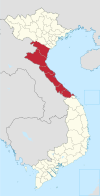
Thieu Hoa is a district (huyện) of Thanh Hóa province in the North Central Coast region of Vietnam.
As of 2003 the district had a population of 190,383.[1] The district covers an area of 175 km². The district capital lies at Vạn Hà.[1]
External links
website : http://thieuhoa.net
References
- ^ a b "Districts of Vietnam". Statoids. Retrieved March 19, 2009.

