Quebrada de los Cuervos
Appearance

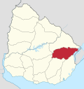
The Quebrada de los Cuervos (Spanish for Crows Ravine) is an important landform in Treinta y Tres Department, Uruguay.
Crossed by the Yerbal Chico creek, it constitutes a natural protected area.[1][2] This Important Bird Area (IBA)[3] is inhabited by several endangered species, such as Agelaius flavus, Heteroxolmis dominicana, Limnoctites rectirostris, Sporophila cinnamomea, Sporophila ruficollis.[4] The very name of this place refers to crow-like Cathartidae which breed on its cliffs: Cathartes burrovianus, Cathartes aura, and Coragyps atratus.[5]
References
[edit]- ^ Crows Ravine (in Spanish)
- ^ Law No. 17234 - Natural Protected Areas System Archived March 2, 2014, at the Wayback Machine (in Spanish)
- ^ Áreas de Importancia para la Conservación de las Aves en el Uruguay (in Spanish)
- ^ Species at the Quebrada de los Cuervos (in Spanish)
- ^ Quebrada de los Cuervos Archived 2013-09-28 at the Wayback Machine (in Spanish)
External links
[edit]Wikimedia Commons has media related to Quebrada de los Cuervos.
- Official website (in Spanish)
- Pictures of the Crows Ravine
- "Woman in land of vultures" (in Spanish). EL PAIS. 20 November 2011.
- "The Crows Ravine in danger of invasion" (in Spanish).
32°55′39″S 54°27′25″W / 32.92750°S 54.45694°W

