Ladis
Appearance
Ladis | |
|---|---|
 Laudegg Castle in Ladis | |
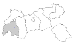
 Location of Ladis within Tyrol | |
| Coordinates: 47°04′00″N 10°37′00″E / 47.06667°N 10.61667°E | |
| Country | Austria |
| State | Tyrol |
| District | Landeck |
| Government | |
| • Mayor | Florian Klotz |
| Area | |
• Total | 7.11 km2 (2.75 sq mi) |
| Elevation | 1,189 m (3,901 ft) |
| Population (2018-01-01)[2] | |
• Total | 531 |
| • Density | 75/km2 (190/sq mi) |
| Time zone | UTC+1 (CET) |
| • Summer (DST) | UTC+2 (CEST) |
| Postal code | 6532 |
| Area code | 05472 |
| Vehicle registration | LA |
| Website | www.ladis.tirol.gv.at |
Ladis is a municipality in the district of Landeck (district) in the Austrian state of Tyrol located 9.5 km south of Landeck and 1.4 km west of Faggen. The village is known because of its sulphur and sour springs. Another important source of income is ski tourism.
References
[edit]- ^ "Dauersiedlungsraum der Gemeinden Politischen Bezirke und Bundesländer - Gebietsstand 1.1.2018". Statistics Austria. Retrieved 10 March 2019.
- ^ "Einwohnerzahl 1.1.2018 nach Gemeinden mit Status, Gebietsstand 1.1.2018". Statistics Austria. Retrieved 9 March 2019.
External links
[edit]Wikimedia Commons has media related to Ladis.


