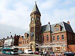
Rock Lane railway station
Appearance
Rock Lane | |
|---|---|
| General information | |
| Location | Rock Ferry, Wirral England |
| Coordinates | 53°22′03″N 3°00′28″W / 53.3676°N 3.0079°W |
| Grid reference | SJ330860 |
| Platforms | Two |
| Other information | |
| Status | Disused |
| History | |
| Opened | June 1846 |
| Closed | 1 November 1862 |
| Original company | Chester and Birkenhead Railway |
| Pre-grouping | Birkenhead Joint Railway |
Rock Lane was a railway station on the Chester and Birkenhead Railway in Cheshire, England. It opened in June 1846 and closed on 1 November 1862,[1] and it consisted of two platforms (only one up to 1847).
In July 1847, the railway became part of the Birkenhead, Lancashire and Cheshire Junction Railway which doubled the line, probably adding the second platform to Rock Lane at this time. In 1862, Rock Lane Station closed, to be replaced with a new station a short distance away, called Rock Ferry.
In 1891, the Birkenhead And Chester Line quadrupled the track, destroying any remains of the station.
References
- ^ Butt, R.V.J. (1995). The Directory of Railway Stations. Yeovil: Patrick Stephens Ltd. p. 198. ISBN 1-85260-508-1. R508.
Further reading
| Preceding station | Historical railways | Following station | ||
|---|---|---|---|---|
| Bebington & New Ferry Line and station open |
GWR & LNWR Chester and Birkenhead Railway |
Tranmere Line and station open | ||


