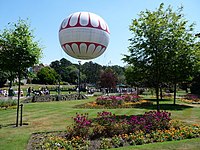
Townsend, Bournemouth
Appearance

Townsend is a area of Bournemouth, Dorset. It is located in the suburbs along the north eastern boundary of the town and is close to the Royal Bournemouth Hospital.[1]
History
Townsend is a housing estate and was built in the mid 1970s.[2]
Politics
Townsend is part of the Muscliff and Strouden Park ward for elections to Bournemouth, Christchurch and Poole Council which elect three councillors.[3]
Townsend is part of the Bournemouth East parliamentary constituency, for elections to the House of Commons of the United Kingdom.[4]
External links
References
- ^ "#GetOutside: do more in the British Outdoors". OS GetOutside. Retrieved 4 October 2020.
- ^ "On our estate: All's changed at vibrant Townsend". Bournemouth Echo. Retrieved 4 October 2020.
- ^ "Muscliff and Strouden Park". www.bcpcouncil.gov.uk. Retrieved 9 May 2021.
- ^ "Labour Market Profile - Nomis - Official Labour Market Statistics". www.nomisweb.co.uk. Retrieved 4 October 2020.
50°45′05″N 1°49′50″W / 50.75139°N 1.83056°W

