Madison Municipal Airport (Indiana)
Appearance
Madison Municipal Airport (KIMS) | |||||||||||
|---|---|---|---|---|---|---|---|---|---|---|---|
| File:Airport Logo BLUE SKY.png | |||||||||||
 | |||||||||||
| Summary | |||||||||||
| Airport type | Public | ||||||||||
| Owner | Madison BOAC, City of Madison, Indiana | ||||||||||
| Operator | City of Madison, Indiana | ||||||||||
| Serves | Madison, Indiana | ||||||||||
| Location | 3919 West IMS Lane, Madison,IN 47250 | ||||||||||
| Elevation AMSL | 819 ft / 250 m | ||||||||||
| Coordinates | 38°45′36″N 085°27′53″W / 38.76000°N 85.46472°W | ||||||||||
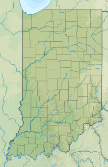
| Map | |||||||||||
 | |||||||||||
| Runways | |||||||||||
| |||||||||||
| Statistics | |||||||||||
| |||||||||||
Madison Municipal Airport (IATA: MDN, ICAO: KIMS, FAA LID: IMS) is a public airport located four miles (6.4 km) west of Madison, in Jefferson County, Indiana, United States.[1]
Facilities
The airport covers 340 acres (140 ha); with one grooved asphalt runway, 3/21, which is 5,000 ft × 75 ft (1,524 m × 23 m). For the 12-month period ending December 31, 2014 the airport had 7,975 aircraft operations, an average of 22 per day: 86% general aviation, 8% air taxi and 6% military. In January 2017, there were 49 aircraft based at this airport: 45 single-engine and 4 multi-engine.[1]

References
- ^ a b c FAA Airport Form 5010 for MDN PDF, effective Jan 5, 2017.
External links
- [1]
- FAA Terminal Procedures for IMS, effective November 28, 2024
- Resources for this airport:
- FAA airport information for IMS
- AirNav airport information for IMS
- ASN accident history for KIMS
- FlightAware airport information and live flight tracker
- SkyVector aeronautical chart for IMS


