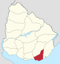
Chihuahua, Uruguay
Appearance
Chihuahua | |
|---|---|
Resort | |
 Sign on the naturist beach | |
| Coordinates: 34°52′30″S 55°5′20″W / 34.87500°S 55.08889°W | |
| Country | |
| Department | Maldonado Department |
| Population (2011) | |
• Total | 37 |
| Time zone | UTC -3 |
| Postal code | 20003 |
| Dial plan | +598 42 (+6 digits) |
Chihuahua is a resort (balneario) in the Maldonado Department of Uruguay.
Geography
[edit]The resort is located on the coast of Río de la Plata, about 12 kilometres (7.5 mi) east of the resort Punta Negra. To the east the resort Punta Ballena and to the west it borders the resort Ocean Park with the stream Arroyo del Portero separating it with the later. This stream carries the water of the Laguna del Sauce to the Río de la Plata.
Population
[edit]In 2011, Chihuahua had a population of 37 permanent inhabitants and 79 dwellings.[1]
| Year | Population | Dwellings |
|---|---|---|
| 1975 | 0 | 5 |
| 1985 | 0 | 7 |
| 1996 | 7 | 11 |
| 2004 | 8 | 38 |
| 2011 | 37 | 79 |
Source: Instituto Nacional de Estadística de Uruguay[2]
See also
[edit]References
[edit]- ^ "Censos 2011 Maldonado (needs flash plugin)". INE. 2012. Archived from the original on 7 September 2012. Retrieved 29 August 2012.
- ^ "1963–1996 Statistics / C". Instituto Nacional de Estadística de Uruguay. 2004. Archived from the original (DOC) on 21 July 2011. Retrieved 28 July 2011.
External links
[edit]Wikimedia Commons has media related to Chihuahua, Uruguay.
- INE map of Sauce de Portezuelo, Ocean Park, Chihuahua and La Capuera
- Official site of Playa Naturista Chihuahua


