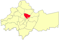
Basman area
Appearance
31°58′N 35°57′E / 31.97°N 35.95°E
Basman
بسمان | |
|---|---|
District | |
 Basman location in Amman Governorate | |
 | |
| Country | |
| Governorate | Amman Governorate |
| Area | |
• District | 13.4 km2 (5.2 sq mi) |
| Population | |
| • Urban | 374,000 |
Basman is a district of the city of Amman, Jordan.
It is Amman's most populous district, located just north of the historical city, with a population of 374,000 as of 2015.[1]
See also
[edit]References
[edit]- ^ "نظام التقسيمات الادارية رقم(46)لسنة2000 وتعديلاته(1)". Ministry of Interiors Jordan (in Arabic). moi.gov.jo. 2000. Archived from the original on 2015-09-26. Retrieved 2015-09-25.

