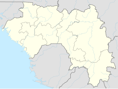
8 November Bridge
Appearance
8 November Bridge Pont 8 Novembre | |
|---|---|
 Location of bridge in peninsula | |
| Coordinates | 9°31′32″N 13°41′18″W / 9.5255°N 13.6882°W |
| Locale | Conakry, Guinea |
| Location | |
 | |
The 8 November Bridge (Pont 8 Novembre) is a bridge in Conakry, Guinea. It has strategic significance, given that the bridge cuts the Central Business District off from the rest of the city. During coups the bridge has played an important role.[1] The bridge was built in the 1960s and demolished on 10 March 2012.[2]
References
[edit]- ^ (Organization), Human Rights Watch (2007). Dying for Change: Brutality and Repression by Guinean Security Forces in Response to a Nationwide Strike. Human Rights Watch. p. 20.
- ^ Camara, Mohamed Saliou; O'Toole, Thomas; Baker, Janice E. (2013). Historical Dictionary of Guinea. Scarecrow Press. p. 242. ISBN 9780810879690.

