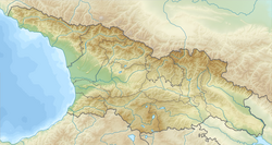
Geri, Georgia
Appearance
Geri
| |
|---|---|
| Coordinates: 42°21′17″N 44°02′05″E / 42.35472°N 44.03472°E | |
| Country | South Ossetia (de facto) Georgia (de jure)[1] |
| Mkhare | Shida Kartli |
| Elevation | 1,480 m (4,860 ft) |
| Population (2014) | |
| • Total | 35 |
| Time zone | UTC+3 (Moscow time) |
| • Summer (DST) | UTC+4 (Moscow summer time) |
 | |
Geri (Georgian: გერი; Ossetian: Джер) is a village in the Gori Municipality of Shida Kartli in central Georgia, and in the Tskhinvali District of South Ossetia.[1]
Notes
[edit]- ^ a b South Ossetia's status is disputed. It considers itself to be an independent state, but this is recognised by only a few other countries. The Georgian government and most of the world's other states consider South Ossetia de jure a part of Georgia's territory.
References
[edit]- Georgian Soviet Encyclopedia Vol. 3, p. 98, 1978.


