Stadnicka Wola
Appearance
Stadnicka Wola | |
|---|---|
Village | |
 | |
| Coordinates: 51°10′26″N 20°25′15″E / 51.17389°N 20.42083°E | |
| Country | |
| Voivodeship | Świętokrzyskie |
| County | Końskie |
| Gmina | Końskie |
| Time zone | UTC+1 (CET) |
| • Summer (DST) | UTC+2 (CEST) |
| Vehicle registration | TKN |
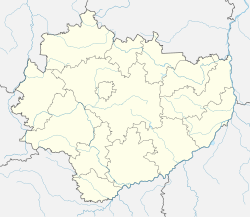
Stadnicka Wola [stadˈnit͡ska ˈvɔla] is a village in the administrative district of Gmina Końskie, within Końskie County, Świętokrzyskie Voivodeship, in south-central Poland. It lies approximately 3 kilometres (2 mi) south of Końskie and 36 km (22 mi) north-west of the regional capital Kielce.[1]
During the German occupation of Poland (World War II), the Germans carried out a massacre of 27 Poles in the forest of Stadnicka Wola on April 8, 1940 (see also Nazi crimes against the Polish nation).[2]
Notable people
- Jadwiga Janus (1931–2019), Polish sculptor
References
- ^ "Central Statistical Office (GUS) – TERYT (National Register of Territorial Land Apportionment Journal)" (in Polish). 2008-06-01.
- ^ Wardzyńska, Maria (2009). Był rok 1939. Operacja niemieckiej policji bezpieczeństwa w Polsce. Intelligenzaktion (in Polish). Warsaw: IPN. p. 254.


