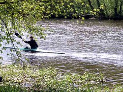
Mukhavets
Appearance
| Mukhavets River | |
|---|---|
 | |
| Location | |
| Country | Belarus |
| Physical characteristics | |
| Source | Confluence of River Mukha and Viets Canal |
| • location | Pruzhany, Belarus |
| • coordinates | 52°33′48.96″N 24°27′8.28″E / 52.5636000°N 24.4523000°E |
| Mouth | Bug |
• location | Brest |
• coordinates | 52°4′52.11″N 23°39′8.5″E / 52.0811417°N 23.652361°E |
| Length | 113 km (70 mi) |
| Basin size | 6,600 km2 (2,500 sq mi) |
| Discharge | |
| • average | 33.6 m3/s (1,190 cu ft/s) |
| Basin features | |
| Progression | Bug→ Narew→ Vistula→ Baltic Sea |
The Mukhavets or Mukhovets (Belarusian: Мухаве́ц (Muchaviec), [muxaˈvʲets], BGN/PCGN romanization: Mukhavyets; Russian: Мухове́ц (Muchovec), Polish: Muchawiec) is a river in western Belarus, a tributary of the Bug.
The river rises in Pruzhany, Belarus, where the Mukha river and the Vyets canal converge, flows through south-western Belarus and merges with the Bug River in Brest.
The river is 113 km long. The basin area is 6,600 km2 (2,500 sq mi).
The river is connected with the Dnieper river by the Dnieper–Bug Canal.
Cities
Tributaries
External links
Books
- (in Russian, English and Polish) Ye.N.Meshechko, A.A.Gorbatsky (2005) Belarusian Polesye: Tourist Transeuropean Water Mains, Minsk, Four Quarters
52°05′01″N 23°38′54″E / 52.0835°N 23.6482°E
