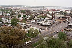
East Moline, Illinois
East Moline, Illinois | |
|---|---|
| City of East Moline | |
 | |
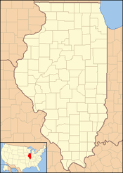
 Location of East Moline in Rock Island County, Illinois. | |
| Coordinates: 41°30′43″N 90°26′07″W / 41.51194°N 90.43528°W | |
| Country | United States |
| State | Illinois |
| County | Rock Island County |
| Incorporated | 1903 |
| Government | |
| • Mayor | Reggi Freeman |
| Area | |
• City | 14.60 sq mi (37.80 km2) |
| • Land | 14.60 sq mi (37.80 km2) |
| • Water | 0.00 sq mi (0.00 km2) |
| Elevation | 577 ft (176 m) |
| Population (2020) | |
• City | 21,374 |
| • Density | 1,464.37/sq mi (565.38/km2) |
| • Metro | 381,342 (134th) |
| • CSA | 474,019 (US: 90th) |
| Time zone | UTC-6 (CST) |
| • Summer (DST) | UTC-5 (CDT) |
| ZIP code | 61244[3] |
| Area code(s) | 309, 861 |
| FIPS code | 17-22073 |
| Interstates | I-74, I-80, I-88, and I-280 |
| Website | www |
East Moline is a city in Rock Island County, Illinois, United States. The population was 21,374 at the 2020 census.[4] East Moline is part of the Quad Cities,[5] along with the cities of Rock Island, Moline, and the Iowa cities of Davenport and Bettendorf. As of 2011, the Quad Cities has a population estimate of 381,342.[6]
Geography
According to the 2010 census, East Moline has a total area of 14.76 square miles (38.23 km2), all land.[7]
East Moline is located at 41°30′43″N 90°26′7″W / 41.51194°N 90.43528°W (41.511940, −90.435203).[8]
Demographics
| Census | Pop. | Note | %± |
|---|---|---|---|
| 1910 | 2,665 | — | |
| 1920 | 8,675 | 225.5% | |
| 1930 | 10,107 | 16.5% | |
| 1940 | 12,359 | 22.3% | |
| 1950 | 13,913 | 12.6% | |
| 1960 | 16,732 | 20.3% | |
| 1970 | 20,832 | 24.5% | |
| 1980 | 20,907 | 0.4% | |
| 1990 | 20,147 | −3.6% | |
| 2000 | 21,431 | 6.4% | |
| 2010 | 21,302 | −0.6% | |
| 2020 | 21,374 | 0.3% | |
| 2022 (est.) | 20,874 | [9] | −2.3% |
| U.S. Decennial Census[10] 2010[11] 2020[12] source | |||
2020 census
| Race | Pop 2010[11] | Pop 2020[12] | % 2010 | % 2020 |
|---|---|---|---|---|
| White (NH) | 13,686 | 11,643 | 64.25% | 54.47% |
| Black or African American (NH) | 2,619 | 3,776 | 12.29% | 17.67% |
| Native American or Alaska Native (NH) | 37 | 29 | 0.17% | 0.14% |
| Asian (NH) | 422 | 787 | 1.98% | 3.68% |
| Pacific Islander (NH) | 14 | 0 | 0.07% | 0.00% |
| Some Other Race (NH) | 24 | 60 | 0.11% | 0.28% |
| Mixed Race/Multi-Racial (NH) | 450 | 816 | 2.11% | 3.82% |
| Hispanic or Latino (any race) | 4,050 | 4,263 | 19.01% | 19.94% |
| Total | 21,302 | 21,374 | 100.00% | 100.00% |
Note: the US Census treats Hispanic/Latino as an ethnic category. This table excludes Latinos from the racial categories and assigns them to a separate category. Hispanics/Latinos can be of any race
As of the United States Census taken in 2000,[13] there were 20,333 people, 8,510 households, and 5,369 families living in the city. The population density was 2,254.9 inhabitants per square mile (870.6/km2). There were 8,988 housing units at an average density of 996.7 per square mile (384.8/km2). The racial makeup of the city was 80.04% White, 7.34% African American, 0.35% Native American, 2.25% Asian, 7.47% from other races, and 2.54% from two or more races. Hispanic or Latino of any race were 15.15% of the population.
Of the 8,510 households 29.5% had children under the age of 18 living with them, 45.1% were married couples living together, 13.9% had a female householder with no husband present, and 36.9% were non-families. 32.1% of households were one person and 14.4% were one person aged 65 or older. The average household size was 2.35 and the average family size was 2.97.
The age distribution was 24.7% under the age of 18, 9.4% from 18 to 24, 26.5% from 25 to 44, 22.4% from 45 to 64, and 17.0% 65 or older. The median age was 37 years. For every 100 females, there were 91.4 males. For every 100 females age 18 and over, there were 85.9 males.
The median income for a household in the city was $35,836, and the median family income was $44,695. Males had a median income of $35,263 versus $23,607 for females. The per capita income for the city was $18,245. About 11.6% of families and 13.9% of the population were below the poverty line, including 20.3% of those under age 18 and 7.0% of those age 65 or over.
Economy
Top employers
According to the City's 2021 Annual Comprehensive Financial Report,[14] the top employers in the city are:
| # | Employer | # of Employees |
|---|---|---|
| 1 | John Deere Harvester Works | 1,300 |
| 2 | Illini Hospital | 700 |
| 3 | East Moline Elementary | 400 |
| 4 | East Moline Correctional Center | 270 |
| 5 | Comprehensive Logistics | 200 |
| 6 | United Township High School | 175 |
| 7 | Aramark | 150 |
| 8 | HC Duke and Son | 130 |
| 9 | Aquent, LLC | 100 |
| 10 | Jacobson Warehouse | 100 |
Education
Elementary schools
- Hillcrest Elementary
- Ridgewood Elementary
- Wells Elementary
- Bowlesburg Elementary
Middle schools
High schools
Special Education schools
- Black Hawk Area Special Education District (BHASED)
Notable people
- Mike Butcher, MLB pitcher, pitching coach.
- Charles F. Carpentier, businessman and politician, lived in East Moline. He served as mayor of East Moline,[15] and also served as Illinois Secretary of State
- Max Hodge, Television writer.
- Spike O'Dell, radio talk show host who left the Quad Cities for Chicago in 1987. He went on to gain fame on WGN. 'Spike' attended McKinley Elementary, Glenview junior, and United Township highschool.
- Laurdine Patrick, jazz musician, father of Massachusetts governor Deval Patrick, was born in East Moline.
References
- ^ "2020 U.S. Gazetteer Files". United States Census Bureau. Retrieved March 15, 2022.
- ^ "City of East Moline". Geographic Names Information System. United States Geological Survey, United States Department of the Interior. Retrieved June 29, 2013.
- ^ "East Moline IL ZIP Code". zipdatamaps.com. 2023. Retrieved January 26, 2023.
- ^ "East Moline city, Illinois". United States Census Bureau. Retrieved February 23, 2021.
- ^ Visit Quad Cities. Visit Quad Cities. Retrieved on April 21, 2012.
- ^ "Annual Estimates of the Population of Metropolitan and Micropolitan Statistical Areas: April 1, 2010 to July 1, 2011". 2011 Population Estimates. United States Census Bureau, Population Division. April 2012. Archived from the original (CSV) on April 27, 2012. Retrieved May 10, 2012.
- ^ "G001 - Geographic Identifiers - 2010 Census Summary File 1". United States Census Bureau. Archived from the original on February 13, 2020. Retrieved December 27, 2015.
- ^ "US Gazetteer files: 2010, 2000, and 1990". United States Census Bureau. February 12, 2011. Retrieved April 23, 2011.
- ^ "City and Town Population Totals: 2020-2022". United States Census Bureau. May 1, 2023. Retrieved May 1, 2023.
- ^ "Decennial Census of Population and Housing by Decades". US Census Bureau.
- ^ a b "P2 HISPANIC OR LATINO, AND NOT HISPANIC OR LATINO BY RACE - 2010: DEC Redistricting Data (PL 94-171) - East Moline, Illinois". United States Census Bureau. Retrieved January 19, 2022.
- ^ a b "P2 HISPANIC OR LATINO, AND NOT HISPANIC OR LATINO BY RACE - 2020: DEC Redistricting Data (PL 94-171) - East Moline, Illinois". United States Census Bureau. Retrieved January 19, 2022.
- ^ "U.S. Census website". United States Census Bureau. Retrieved January 31, 2008.
- ^ City of East Moline ACFR. (PDF). Retrieved on August 18, 2022.
- ^ 'Illinois Blue Book 1963-1964, Biographical Sketch of Charles F. Carpentier, pg. 76
External links


