Veterans Memorial Dam
Appearance
| Veterans Memorial Dam | |
|---|---|
| Official name | Veterans Memorial (Main) Dam (LOWA Dam No. 1) |
| Country | United States |
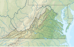
| Location | Lake of the Woods, Orange County, Virginia |
| Coordinates | 38°20′59″N 77°45′17″W / 38.34972°N 77.75472°W |
| Status | Operational |
| Opening date | 1968 |
| Owner(s) | Lake of the Woods Association, Inc. |
| Dam and spillways | |
| Type of dam | Embankment, earth-fill |
| Impounds | Flat Run |
| Height | 60 ft (18 m) |
| Length | 1,450 ft (442 m) |
| Elevation at crest | 325.5 ft (99 m) |
| Spillway capacity | 4,000 cu ft/s (113 m3/s) |
| Reservoir | |
| Creates | Lake of the Woods |
| Total capacity | 13,800 acre⋅ft (17,022,049 m3) |
| Catchment area | 7.12 sq mi (18 km2) |
| Surface area | 639 acres (259 ha) |
The Veterans Memorial Dam (National ID # VA13701), also known as the Lake of the Woods Main Dam, is an earth-fill embankment dam on the Flat Run located 15.3 mi (25 km) west of Fredericksburg, Virginia.
The dam was constructed in 1968 with the primary purpose of recreation. Surrounding its reservoir is the resort community of Lake of the Woods.[1] The Lake of the Woods Association owns the dam.
References
- ^ "Lake of the Woods Association, Inc. Veterans Memorial (Main) Dam (Dam No. 1) on Flat Run Orange County, Virginia" (PDF). Emergency Action Plan. Lake of the Woods Association, Inc. Retrieved 11 May 2012.

