Drummersdale
Appearance
| Drummersdale | |
|---|---|
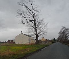
 Drummersdale Mission Church | |
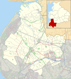
Location within Lancashire | |
| OS grid reference | SD394129 |
| Civil parish | |
| District | |
| Shire county | |
| Region | |
| Country | England |
| Sovereign state | United Kingdom |
| Post town | ORMSKIRK |
| Postcode district | L40 |
| Dialling code | 01704 |
| Police | Lancashire |
| Fire | Lancashire |
| Ambulance | North West |
| UK Parliament | |
Drummersdale is a hamlet in the civil parish of Scarisbrick, West Lancashire, England.
Etymology
[edit]The etymology is doubtful, although the final element of the name is certainly either Old English dæl "dale, valley" or the cognate Old Norse dalr, as in Rochdale. The name was recorded as Drimersdele in 1152.
Transport
[edit]Drummersdale lies on the B5242 road and is near Bescar Lane railway station on the Manchester to Southport line.
External links
[edit]Wikimedia Commons has media related to Drummersdale.
- Map sources for Drummersdale


