Uitweg
Appearance
Uitweg | |
|---|---|
Town | |
 Uitweg | |
 | |
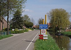
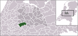
 Uitweg in the municipality of Lopik. | |
| Coordinates: 51°58′57″N 5°0′52″E / 51.98250°N 5.01444°E | |
| Country | Netherlands |
| Province | Utrecht (province) |
| Municipality | Lopik |
| Population (2018) | |
| • Total | 565 |
| Time zone | UTC+1 (CET) |
| • Summer (DST) | UTC+2 (CEST) |
Uitweg is a town in the Dutch province of Utrecht. It is a part of the municipality of Lopik, and lies about 5 km southwest of IJsselstein. The town consists almost completely of a ribbon of farms along the Enge IJssel and Lopiker Wetering rivers, between Graaf and Lopikerkapel. It has about 471 inhabitants.[1]
References
Wikimedia Commons has media related to Uitweg.
