
Lienden
51°57′N 5°31′E / 51.950°N 5.517°E
Lienden | |
|---|---|
 Flag  Coat of arms | |
 | |
 The town centre (dark green) and the statistical district (light green) of Lienden in the municipality of Buren. | |
| Country | Netherlands |
| Province | Gelderland |
| Municipality | Buren |
| Area | |
| • Total | 2,006 km2 (775 sq mi) |
| Population | 6,000 |
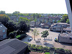
Lienden is a town in the Dutch province of Gelderland. It is a part of the municipality of Buren, and lies about 9 km south of Veenendaal.
Lienden was a separate municipality until 1999, when it was merged with Buren.[1]
In 2007, the town of Lienden had 6230 inhabitants. The built-up area of the town was 0.81 km², and contained 1147 residences.[2] The statistical area "Lienden", which also can include the peripheral parts of the village, as well as the surrounding countryside, has a population of around 4200.[3]
-
 The Lordship of Lienden in 1626
 -
-
-
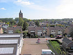
 Church: de Maagd Maria
 -
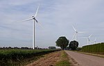 Windfarm at the Zilverlandseweg


See also
- van Lynden family.
References
- ^ Ad van der Meer and Onno Boonstra, Repertorium van Nederlandse gemeenten, KNAW, 2011.
- ^ Statistics Netherlands (CBS), Bevolkingskernen in Nederland 2001 Archived March 19, 2006, at the Wayback Machine. (Statistics are for the continuous built-up area).
- ^ Statistics Netherlands (CBS), Statline: Kerncijfers wijken en buurten 2003-2005 Archived 2006-07-24 at WebCite. As of 1 January 2005.
External links
- Template:Kuyper Map of the former municipality, around 1868.
This Gelderland location article is a stub. You can help Wikipedia by expanding it. |