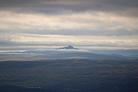
Jonsknuten
Appearance
| Jonsknuten | |
|---|---|
 Jonsknuten seen from Storeble | |
| Highest point | |
| Elevation | 903.8 to 904 m (2,965 to 2,966 ft) |
| Prominence | 409.8 to 410 m (1,344 to 1,345 ft) |
| Isolation | 18.1 to 18.3 km (11.2 to 11.4 mi) |
| Geography | |
 | |
| Location | Buskerud, Norway |
Jonsknuten is a mountain in the municipality of Kongsberg in Buskerud, Norway.
59°40′15″N 9°31′19″E / 59.67083°N 9.52194°E
