Arthur's Town Airport
Appearance
Arthur's Town Airport | |||||||||||
|---|---|---|---|---|---|---|---|---|---|---|---|
 | |||||||||||
| Summary | |||||||||||
| Airport type | Public | ||||||||||
| Location | Arthur's Town, Bahamas | ||||||||||
| Elevation AMSL | 18 ft / 5 m | ||||||||||
| Coordinates | 24°37′46″N 075°40′26″W / 24.62944°N 75.67389°W | ||||||||||
| Map | |||||||||||
 | |||||||||||
| Runways | |||||||||||
| |||||||||||
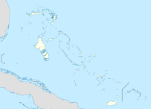
Arthur's Town Airport (IATA: ATC, ICAO: MYCA)[2][1] is an airport in Arthur's Town on Cat Island in the Bahamas.
Airlines and scheduled destinations
| Airlines | Destinations |
|---|---|
| SkyBahamas[3][failed verification] | Nassau, New Bight |
Charter flights
Aeroshares Charter, LLC services Cat Island from worldwide locations.[4]
Charter service is also available from Florida or Nassau.[5]
References
- ^ a b Template:WAD
- ^ Accident history for ATC at Aviation Safety Network
- ^ "SkyBahamas Routes and Tables". SkyBahamas. Archived from the original on 27 January 2013. Retrieved 20 September 2012.
- ^ Aeroshares.com
- ^ Bahamas.com

