
Žihobce
Žihobce | |
|---|---|
Municipality | |
 | |
 Flag  Coat of arms | |
 Žihobce | |
| Coordinates: 49°12′56″N 13°37′55″E / 49.21556°N 13.63194°E | |
| Country | |
| Region | Plzeň |
| District | Klatovy |
| Area | |
| • Total | 25.8 km2 (10.0 sq mi) |
| Elevation | 543 m (1,781 ft) |
| Population (1.1.2015) | |
| • Total | 608 |
| • Density | 24/km2 (61/sq mi) |
| Postal code | 341 62 to 342 01 |
| Website | http://www.sumavanet.cz/zihobce/ou |
Žihobce is a village and municipality (obec) in Klatovy District in the Plzeň Region of the Czech Republic.
The municipality covers an area of 25.8 square kilometres (10.0 sq mi), and has a population of 658 (as at 28 August 2006).
Žihobce lies approximately 33 kilometres (21 mi) south-east of Klatovy, 62 km (39 mi) south of Plzeň, and 113 km (70 mi) south-west of Prague.
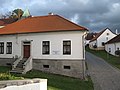
Gallery
-
 Church of "Proměnění Páně"
 -
 Centre with statue of Jan Nepomucký
 -
 Roman Catholic parish in Žihobce
.jpg)
.jpg)
.jpg)
References
Wikimedia Commons has media related to Žihobce.
| Authority control databases: National |
|---|
This Plzeň Region location article is a stub. You can help Wikipedia by expanding it. |