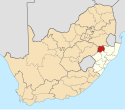
Ingogo
Appearance
Ingogo | |
|---|---|
| Coordinates: 27°34′41″S 29°54′43″E / 27.578°S 29.912°E | |
| Country | South Africa |
| Province | KwaZulu-Natal |
| District | Amajuba |
| Municipality | Newcastle |
| Time zone | UTC+2 (SAST) |
| PO box | 2944 |
Ingogo is a locality some 25 km north of Newcastle, site of a battle on 8 February 1881, during the First Anglo-Boer War, in which British casualties numbered 76 while Boer losses amounted to 8. The name is derived from that of the Ngogo River. The form iNgogo has been approved.[1]
References
- ^ Raper, Peter E. (1987). Dictionary of Southern African Place Names. Internet Archive. p. 222. Retrieved 28 August 2013.


