Castlejordan (civil parish)
Castlejordan
Caisleán Shiurdáin | |
|---|---|
| Coordinates: 53°24′49″N 7°17′39″W / 53.41361°N 7.29417°W | |
| Country | |
| Province | Leinster |
| County | County Westmeath |
| Irish grid reference | [1] |
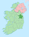
Castlejordan (Irish: Caisleán Shiurdáin) is a civil parish in County Meath[1] and County Offaly,[2] Ireland. It is located to the south of Kinnegad.[3]
Castlejordan lies in the baronies of Coolestown, Upper Moyfenrath and Warrenstown.[4]
Castlejordan civil parish comprises 27 townlands, with 15 in County Meath and 12 in County Offaly. The townlands in Castlejordan are: Ballydonnell, Ballyfore, Ballynagalshy, Baltigeer, Baltinoran, Cappaboggan, Castlejordan, Clongall, Derryhinch, Gortnahorna, Kildangan, Kilkeeran, Lewellensland, Toor, Toornafolla, Carrick, Clonlack, Clonmeen, Clonmore, Corbetstown, Derrygreenagh, Garr, Killowen, Knockdrin, Stonehouse, Toberdaly
The neighbouring civil parishes are: Balfeaghan to the north and east, Croghan, Ballyburly and Ballymacwilliam to the south and Pass of Kilbride and Castlelost to the west.
References
- ^ "Meath civil parishes". www.johngrenham.com. Retrieved 1 May 2020.
- ^ "Offaly civil parishes". www.johngrenham.com. Retrieved 1 May 2020.
- ^ "Townlands in Castlejordan". www.townlands.ie. Retrieved 1 May 2020.
- ^ "Caisleán Shiurdáin/Castlejordan". Logainm.ie. Retrieved 1 May 2020.


