Chub Cay International Airport
Appearance
Chub Cay International Airport | |||||||||||
|---|---|---|---|---|---|---|---|---|---|---|---|
| Summary | |||||||||||
| Airport type | Private | ||||||||||
| Serves | Chub Cay | ||||||||||
| Location | Frazers Hog Cay | ||||||||||
| Elevation AMSL | 5 ft / 2 m | ||||||||||
| Coordinates | 25°25′02″N 077°52′51″W / 25.41722°N 77.88083°W | ||||||||||
| Map | |||||||||||
 | |||||||||||
| Runways | |||||||||||
| |||||||||||
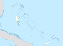
Chub Cay Airport is an airport in Chub Cay in the Berry Islands in The Bahamas (IATA: CCZ, ICAO: MYBC). The airport actually lies in Frazers Hog Cay.
Airlines and destinations
| Airlines | Destinations |
|---|---|
| Pineapple Air | Nassau |
References
External links

