Bessungen
Bessungen | |
|---|---|
| Coordinates: 49°51′28″N 8°39′4″E / 49.85778°N 8.65111°E | |
| Country | Germany |
| State | Hesse |
| District | urban district |
| City | Darmstadt |
| Area | |
• Total | 5.53 km2 (2.14 sq mi) |
| Elevation | 180 m (590 ft) |
| Population (2011-03-31) | |
• Total | 13,059 |
| • Density | 2,400/km2 (6,100/sq mi) |
| Time zone | UTC+01:00 (CET) |
| • Summer (DST) | UTC+02:00 (CEST) |
| Postal codes | 64285, 64295 |
| Dialling codes | 06151 |
Bessungen is a district in the South of the city of Darmstadt in Hesse, Germany.
History
Until 1888 Bessungen was a separate municipality. Bessungen is known as "the oldest part of Darmstadt", and was first mentioned in writings in 1002. It was probably founded earlier, in about the 5th Century by the Alemanni.
Geography
There are foothills of the Middle Odenwald in the southeast of the district. The Saubachgraben forms the southern boundary of the district. East of the low-Ramstädter street is the Darmstadt Ostwald and fields. West of the district are homes and heading North to the Darmstadt city center is terrain flat, these districts are part of the Upper Rhine Plain.
Key features
Old preserved village homes and peasant courtyard are near to high-rise development of 19th and 20th Century. The Bessunger church is at the center of the Bessungen district, with the old village buildings, that runs along the Ludwigshöh road. On the Heidelberg Road and the Moosbergstraße road one finds the stately homes of the early days. Also in the Bessungen district is the old Darmstadt cemetery, the Campus Lichtwiese of Technischen Universität Darmstadt and at Böllenfalltor sports facilities. South of Bessungen district is the Heidelberg road go to Eberstadt . The Orangerie and the Mosersche garden are highlights of Bessungen district.
History

Archaeological finds indicate that Bessungen was settled in the 4th or 5th Century. Bessungen of an Alemanni origin. Bessungen means "for the people of Bezzo", Bezzo is a modified word form of “Bernhard”. Bernhard was probably an Alemannic nobility, whose allegiance settled the village of Bessungen. As Bessungen was at the crossroads of Roman roads in medieval times. The Bessunger Church was founded in 1002. On the date of 10 June 1002 is the first written mention Bessungens. In this document of Henry II, Holy Roman Emperor, at that time with the royal court Gerau, wrote about Bessungens, the Bishopric of Bamberg and the Bishopric of Worms. In 1479 the city officially became known as Bessungen, by inheritance. The Thirty Year War was hard on Bessungen. In January 1635, the city was burned down by French troops almost completely. Only a few houses remained standing. The surviving inhabitants fled behind the walls of the Darmstadt, where many of them died of the plague. By the end of the war in 1648 only about 30 people were left in Bessungen, who set then out to rebuild the community. By the beginning of the 18th Century Bessungen has fully recovered. Due to population grow in 1875 Darmstadt and Bessungen grew together to be one city. Grand Duchy of Hesse opened a headquarters center in Darmstadt and Bessungen experienced a growth in population again. On 1 April 1888 Bessungen was incorporated after negotiations with Darmstadt. During World War II Bessungen was largely spared from mass damage.
Present day, Bessungen does not have its own town council. All Bessungen matters managed in by the city council and municipal authorities of the city of Darmstadt.
Coat of arms
This section needs expansion. You can help by adding to it. (September 2016) |
The Bessunger coat of arms shows the three legged “judgment” seat.[further explanation needed]
Orangerie

The Orangerie in Darmstadt was designed by architect Louis Remy de la Fosse, built from 1719 to 1721 . It served as a winter shelter for Sardinian or Sicilian orange trees of the surrounding park. Shortly after the World War 2 it was used temporary for the quarters for the State Theatre in Darmstadt. Later the Orangerie park was designed by the Palatine court gardener JK Ehret from Heidelberg. The symmetrical baroque complex consists of three -tiered garden, fountains and wide tree-lined avenues . The northern end is the sandstone gate of the former Palais market. The Bessungen orangery building is now used for concerts and meetings, also has a restaurant.


Trams and buses
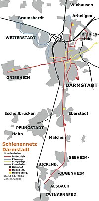
Darmstadt started in 1886 with a steam tram system, that later evolved (with a short period of also including trolleybuses from 1944 to 1963) into a 36.2 km network by 2001.[1] Darmstadt had not scrapped this comparatively extensive network after World War II as many other cities did, though some links were decommissioned in the 1960s and 1970s and replaced by bus lines[1] of which the city also has an extensive network. Tram Lines 6,7, and 8 service Darmstadt-Arheilgen. The central nodal point of the Darmstadt tramway network is the Luisenplatz in the city center of Darmstadt.
Boroughs of Darmstadt
Darmstadt has 9 official 'Stadtteile' (boroughs). These are, alphabetically:[2]
|
|
|

References
- ^ a b Darmstadt: A mature tramway grows again Archived 2012-02-16 at the Wayback Machine – Tramways & Urban Transit, September 2001 issue, pp. 334–336. Accessed 7 December 2010.
- ^ Statistischer Ueberblick Archived 2007-06-16 at the Wayback Machine ('Statistical overview', from the official city website, in German)
External links
- Official website of the city of Darmstadt (German and parts in English)
- Map of the City of Darmstadt, with bus and tram stops


