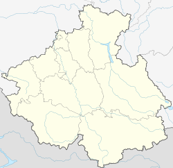
Paspaul
Appearance
Paspaul
Паспаул | |
|---|---|
Village | |
| Coordinates: 51°56′N 86°20′E / 51.933°N 86.333°E[1] | |
| Country | Russia |
| Region | Altai Republic |
| District | Choysky District |
| Time zone | UTC+7:00 |
Paspaul (Template:Lang-ru) is a rural locality (a selo) and the administrative center of Paspaulskoye Rural Settlement of Choysky District, the Altai Republic, Russia. The population was 1243 as of 2016.[2] There are 21 streets.
Geography
The village is located east from Gorno-Altaysk, in the valley of the Malaya Isha River.
References
- ^ "Карта села Паспаула в Алтае с улицами и номерами домов". MapData.ru. Retrieved 2018-10-03.
- ^ "Оценка численности постоянного населения Республики Алтай по населённым пунктам за 2012-2016 годы". statra.gks.ru. Archived from the original on 2019-03-04. Retrieved 2018-09-24.


