Mbanza-Ngungu
Mbanza-Ngungu | |
|---|---|
City and Territory | |
| Coordinates: 5°15′S 14°52′E / 5.250°S 14.867°E | |
| Country | |
| Province | Kongo Central |
| District | Cataractes |
| Area | |
• Total | 8,190 km2 (3,160 sq mi) |
| Population (2004) | |
• Total | 100,000 |
| • Density | 12/km2 (32/sq mi) |
| Time zone | UTC+1 (WAT) |
Mbanza-Ngungu, formerly known as Thysville or Thysstad, named after Albert Thys, is a city and territory in Kongo Central Province in the western part of the Democratic Republic of Congo, lying on a short branch off the Matadi-Kinshasa Railway. It has a population of nearly 100,000 people.
Overview
Formerly known as a resort town, it is home to the Thysville Caves, which encompass the entire range of the colourless African blind barb. It is home to a major FARDC garrison: the 1st Armoured Brigade was based here during the early '90s period.[1] The 1st Armoured Brigade was first listed in the IISS Military Balance in 1982-83 edition, implying that the brigade may have been created during that period.[2] The city's other main industry is railway engineering.
The city is currently the main site of Kongo University.
Gallery
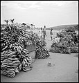
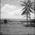
Swiss photographer Annemarie Schwarzenbach, took photos from May 1941 until March 1942. They are shown below.
-
Two (2) trains, one has derailed, the other came to help.
-
Daily live.
-
View of the village.
-
Hills around Mbanza-Ngungu.
See also
References
- ^ Ed. by Sandra W. Meditz and Tim Merrill, Country Study for Zaire, 1993, Library of Congress
- ^ IISS Military Balance 82/83, page 71


