Adabar Thana
(Redirected from Adabor Thana)
Adabar
আদাবর | |
|---|---|
Thana | |
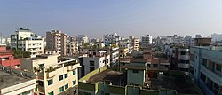
 Skyline of Adabar | |
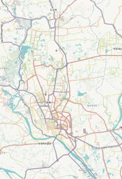
 Expandable map of vicinity of Adabar Thana | |
| Coordinates: 23°46′17″N 90°21′33″E / 23.77132866°N 90.35915521°E | |
| Country | Bangladesh |
| Area | |
| • Total | 2.07 km2 (0.80 sq mi) |
| Population (2011)[1] | |
| • Total | 203,989 |
| • Density | 98,545/km2 (255,230/sq mi) |
| Area code | 1207[2] |
Adabar is a Thana of Dhaka District located on the bank of Buriganga river, in Bangladesh. To the north, there is Darus Salam Thana and Sher-e-Bangla Nagar, to the east and south, there is Mohammadpur Thana and to the west, there is Buriganga river.
History[edit]
Administration Adabar thana was formed on 27 June 2007 comprising part of Mohammadpur Thana.[3]
See also[edit]
References[edit]
- ^ Bangladesh Bureau of Statistics (2011). "Population & Housing Census" (PDF). Bangladesh Government. Archived from the original (PDF) on 3 September 2017. Retrieved 17 April 2015.
- ^ "ঢাকা পোস্টকোড". ডাক অধিদপ্তর. Retrieved 2024-01-17.
- ^ "Adabar Thana - Banglapedia". en.banglapedia.org. Retrieved 2022-01-19.


