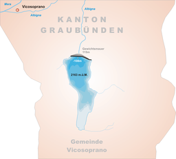
Albigna lake
Appearance
| Albigna lake Lägh da l'Albigna Lago da l'Albigna | |
|---|---|
 | |
 | |
| Location | Bregaglia, Graubünden |
| Coordinates | 46°19′48″N 9°38′51″E / 46.33000°N 9.64750°E |
| Type | reservoir |
| Primary inflows | mountain streams |
| Primary outflows | Albigna |
| Catchment area | 20.5 km² |
| Basin countries | Switzerland |
| Surface area | 1.13 km² |
| Max. depth | 108 m |
| Surface elevation | 2,163 m |
Albigna Lake (German: Albignasee, Italian: Lago da l'Albigna, Romansh: Lägh da l'Albigna) is a reservoir in the canton of Graubünden, Switzerland. It is located in the municipality of Vicosoprano at an elevation of 2,163 m on the southwest side of the Bregaglia valley, northeast of Pizzo Cacciabella. The lake has a surface area of 1.13 km². Its outflow, the Albigna River, is a left tributary of the Mera River.
External links
 Media related to Albigna lake at Wikimedia Commons
