Asfeld
Asfeld | |
|---|---|
 Town hall and square | |
| Country | France |
| Region | Grand Est |
| Department | Ardennes |
| Arrondissement | Rethel |
| Canton | Asfeld |
| Intercommunality | Asfeldois |
| Government | |
| • Mayor (2001–2020) | Jean-Marie Briois |
Area 1 | 22.19 km2 (8.57 sq mi) |
| Population (2010) | 1,077 |
| • Density | 49/km2 (130/sq mi) |
| Time zone | UTC+01:00 (CET) |
| • Summer (DST) | UTC+02:00 (CEST) |
| INSEE/Postal code | 08024 /08190 |
| Elevation | 60–118 m (197–387 ft) |
| 1 French Land Register data, which excludes lakes, ponds, glaciers > 1 km2 (0.386 sq mi or 247 acres) and river estuaries. | |
Asfeld is a French commune in the Ardennes department in the Grand Est region of north-eastern France.
The inhabitants of the commune are known as Asfeldois.[1]
The commune has been awarded one flower by the National Council of Towns and Villages in Bloom in the Competition of cities and villages in Bloom.[2]
Geography
Asfeld is located some 35 km east by south-east of Laon and 8 km north-east of Neufchâtel-sur-Aisne. Access to the commune is by road D 926 from Vieux-lès-Asfeld in the south-west passing through the town and continuing north-east to Aire. The D 37 also goes from the town north-west to Villers-devant-le-Thour. The D 18 from Villers-devant-le-Thour to the D 926 north of Balham passes through the north-east corner of the commune. The D 137 road branches off the D 18 in the commune and goes south-west to Avaux. The D 237 goes from the town south-east to Roizy. Apart from the town there is also the village of Juzancourt in the north of the commune. The commune is mainly farmland with some forested areas near the river and in the north.[3]
The Aisne river passes through the commune from east to west forming a part of the eastern border and continuing south-west to eventually join the Oise at Compiègne. The Canal des Ardennes also passes through the commune parallel to the Aisne. The Ruisseau des Barres forms the eastern border of the commune as it flows south to join the Aisne.
Neighbouring communes and villages
History

A fortified point beside the Aisne
Asfeld was a village formerly called Ecry where the Vikings were defeated in 883.
In the Middle Ages, the Lords of Escry built a fortified residence. It was passed to the Grandpré family then to the Bossut. The chateau suffered numerous assaults: in 1359 it was sacked by the troops of Edward III riding from Calais to Reims then again by the Burgundians around 1425.
In 1625 it was again attacked by Charles IV, Duke of Lorraine, profiting from the Fronde to plunder Champagne and threaten Île-de-France.
In 1671, Jean-Jacques de Mesmes, Count of Avaux bought the fief of Ecry after it had been devastated by these successive invasions to complete his territory. The main town of Ecry was then renamed Avaux-la-ville.
From Avaux-la-Ville to Asfeld
Jean-Jacques de Mesmes stimulated the local economy by establishing a weekly market and two annual fairs. He strengthened and enlarged the chateau and its approaches.
In 1680 he decided to build a new church as the existing church was in a particularly bad state. This construction was part of an overall plan for the surroundings of the château.[4] The new church building was blessed on 15 June 1685.
On 20 March 1728 Claude François Bidal d'Asfeld bought the County of Avaux which was created from Avaux-le-Château, Avaux-la-Ville, Aire, Vieux, and Vauboison. In 1730 this lordship was raised to a marquisate. Avaux-la-Ville, which had been called Ecry until 1671, again changed its name and took the current name of Asfeld.
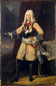
Claude François Bidal Asfeld was Lieutenant-General of the armies (equivalent to General of division of the King and Director-general of fortifications, succeeding to this function from Vauban.
At the same time, Nicolas Bidet from Reims, a winemaker and author of a botanical treatise on the nature and the culture of grapevines, became Lord of Juzancourt, now a hamlet in Asfeld commune.
Revolutions and political upheavals
The son of Claude François Bidal d'Asfeld, Claude Étienne, the second Marquis of Asfeld lived mainly in Paris but had strong relationships with the inhabitants of Asfeld. The French Revolution of 1789 accentuated the conflicts.
The gates of the château were forced open on 13 June 1790. The Marquis of Asfeld condemned the leaders but on 25 August 1792, hearing of the fall of the monarchy, mobs again entered the property of the Marquis and symbolically burned his Charter.[4] The Marquis preferred to emigrate to Aachen following the French Revolution. His assets were seized and sold as Biens nationaux (national property). The castle was demolished the following year. The church was spared.
During the Revolution the commune took the name of Écry-le-Franc or Escry-le-Franc.[5]
In 1814, during the Battle for France, the region of Berry-au-Bac in Asfeld was the scene of fighting between Field Marshal Blücher, the Duke of Ragusa, and General Ricard.[6]
In February 1848 a native of Asfeld, the botanist Jean-Baptiste Payer, participated in the revolutionary events in Paris, became Chief of staff for Lamartine then enjoyed a burgeoning popularity in his native region and was elected MP for Ardennes in the French Second Republic although it was ephemeral.
At the end of the 19th century and beginning of the 20th century the construction of railways was encouraged by freight traffic from the sugar beet industry. Spurred by the brothers Jules and Désiré Linard, the railway was quickly built and created potential for further diversification for farmers.
Conflicts of the 20th century
Throughout the 1914-1918 war the area was close to combat zones until the final days[7] and suffered extensive damage. In 1940 after the breakthrough at Sedan in May, it was along the Aisne and in particular at Asfeld that a line of defence against the German invasion was attempted to be organized in early June without much success. In the years that followed, resistance movements emerge, such as the FTP.
Heraldry
 |
The Croix de guerre 1914-1918 was awarded to the commune on 17 September 1921.
|
Administration
List of Successive Mayors[8]
| From | To | Name | Party | Position |
|---|---|---|---|---|
| 2001 | 2020 | Jean-Marc Briois |
(Not all data is known)
Demography
In 2010 the commune had 1,077 inhabitants. The evolution of the number of inhabitants is known from the population censuses conducted in the commune since 1793. From the 21st century, a census of communes with fewer than 10,000 inhabitants is held every five years, unlike larger towns that have a sample survey every year.[Note 1]
Template:Table Population Town

Culture and heritage
Asfeld is a stage on the Route de Porcien, a tourist route promoted by the Tourism Office of Ardennes
Civil heritage
- The former Arlot Flour Mill (17th century)
 [9]
[9] - The German War cemetery
-
Asfeld Town Hall
-
Entrance to the German War cemetery
-
The German War cemetery
-
Inside the German War cemetery
-
Commemorative Plaque at the German cemetery
-
The War Memorial
-
Asfeld college
-
Community of communes office
-
Police Station
-
Fire Station
Religious heritage
- The Church of Saint-Didier (17th century)
 [10] contains a:
- Painting: The Martyrdom of Saint-Sebastian
 [11]
[11]
- Painting: The Martyrdom of Saint-Sebastian
- The Chapel of Notre-Dame-de-Pitié contains a Sculpture of the Virgin of Pity
 [12]
[12]
-
Church of Saint-Didier
-
Entrance to the Church of Saint-Didier
-
Plan of the church
-
Choir of the church
-
The church organ
-
The main Altar
-
Stained glass in the church
-
Table in the church
-
Chapel of Notre-Dame de la Pitié

Notable people linked to the commune
- Jean-Jacques de Mesmes, Count of Avaux
- Claude François Bidal d'Asfeld
- Nicolas Bidet of Juzancourt
- Jean-Baptiste Payer
- Désiré Linard
See also
Notes
- ^ At the beginning of the 21st century, the methods of identification have been modified by Law No. 2002-276 of 27 February 2002, the so-called "law of local democracy" and in particular Title V "census operations" allows, after a transitional period running from 2004 to 2008, the annual publication of the legal population of the different French administrative districts. For communes with a population greater than 10,000 inhabitants, a sample survey is conducted annually, the entire territory of these communes is taken into account at the end of the period of five years. The first "legal population" after 1999 under this new law came into force on 1 January 2009 and was based on the census of 2006.
References
- ^ Inhabitants of Ardennes Template:Fr icon
- ^ Asfeld in the Competition for Towns and Villages in Bloom Archived December 10, 2014, at the Wayback Machine Template:Fr icon
- ^ Google Maps
- ^ a b Philippe Seydoux, Country seats and fortified Houses in Champagne, Marne, and Ardennes, Éditions de La Morande, 1997, Vol. 1, 320 pages, p. 94-97, ISBN 2-902091-30-3 and Plan of the Château d'Avaux-la-Ville, p. 95 Template:Fr icon
- ^ Communal Notice - Asfeld Template:Fr icon
- ^ Jean Baptiste Frédéric Koch, Memoir to serve as a history of the campaign of 1814,, volume 2, Paris, 1819, Read online Template:Fr icon
- ^ Joseph Prudhon, Journal of a Soldier 1914-1918: Recalling the miseries of the Great War, L'Harmattan, 2010, ISBN 978-2-296-12855-2, Read online Template:Fr icon
- ^ List of Mayors of France Template:Fr icon
- ^ Ministry of Culture, Mérimée IA08000312 Arlot Flour Mill Template:Fr icon
- ^ Ministry of Culture, Mérimée PA00078333 Church of Saint-Didier Template:Fr icon
- ^ Ministry of Culture, Palissy PM08000635 Painting: The Martyrdom of Saint Sebastian Template:Fr icon
- ^ Ministry of Culture, Palissy PM08000025 Sculpture: Virgin of Pity Template:Fr icon


