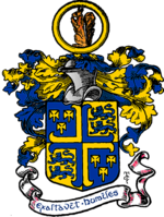
Aston Manor
| Aston Manor | |
|---|---|
| Population | |
| • 1901 | 77,326 |
| • 1911 | 75,029 |
| History | |
| • Created | 1869 |
| • Abolished | 1911 |
| • Succeeded by | County Borough of Birmingham |
| Status | Local board of health 1869–1903 Urban district 1894–1903 Municipal borough 1903–1911 |
 | |
Aston Manor was a local government district of Warwickshire in what is now northern Birmingham, from the 19th century to 1911, when it was added to Birmingham.
The Aston Manor Local Board of Health was formed in 1869, from part of the ancient parish of Aston. It became an urban sanitary district in 1875, and then under the Local Government Act 1894 became an urban district with a directly elected council. Aston Manor covered the area today known as Aston, including Aston Park, along with Lozells. It was immediately to the north of the county borough of Birmingham. There were extensive manufacturing facilities, including those of motors and cycles with their accessories, also paper-mills, breweries, etc. The population then was largely industrial. The district contained the now publicly owned Aston Hall.[1]
Aston Manor was granted a charter of incorporation to become a municipal borough in 1903. The census of 1911 recorded a population of around 75,000 in the borough, enough for it to become a county borough in its own right.[2] It instead was added to the county borough of Birmingham that year.[3][full citation needed]
Notable people[edit]
- Victor Johnson (1883–1951) was a track cycling racer who, in 1908, won a gold medal at the Olympics. He became World Amateur Sprint Champion in Germany and the British National Quarter-mile Champion.
See also[edit]
References[edit]
- ^ One or more of the preceding sentences incorporates text from a publication now in the public domain: Chisholm, Hugh, ed. (1911). "Aston Manor". Encyclopædia Britannica. Vol. 2 (11th ed.). Cambridge University Press. p. 793.
- ^ VoB - Aston Manor
- ^ Youngs, Volume 2
