Battle of Grand Coteau
| Battle of Grand Coteau (North Dakota) | |||||||
|---|---|---|---|---|---|---|---|
| |||||||
| Belligerents | |||||||
| Métis buffalo hunters | Sioux (Yanktonai) | ||||||
| Commanders and leaders | |||||||
| Jean Baptiste Falcon[1] | Chief Medicine Bear[2][3] | ||||||
| Strength | |||||||
| 67-77[1] | 2,000[1] | ||||||
| Casualties and losses | |||||||
|
1 dead[1] 12 horses killed |
15-80 dead[1][4] 65 horses killed[1][4] | ||||||
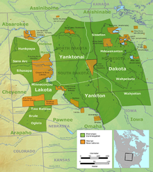
The Battle of Grand Coteau (North Dakota) or the Battle of Grand Coteau du Missouri was a battle fought between Métis buffalo hunters of Red River and the Sioux in North Dakota between July 13 and 14, 1851. The Métis were victorious. It was the last major battle between the two groups.[1]
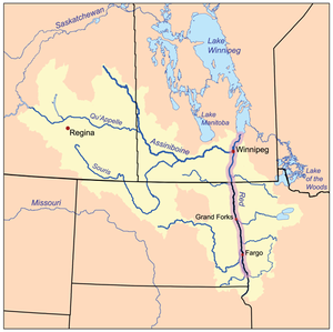
The buffalo hunt was a yearly event for the Métis of the Red River Colony. After sowing their fields in the spring they set out with their wives and children leaving the aged and infirm to take care of the crop.[5] Their principal settlement was situated on the banks of the Red River of the North in what is now the city of Winnipeg, Manitoba, Canada. Made up largely of French Métis they would leave for the summer buffalo hunt around the middle of June and returned in the middle of August with their pemmican and dried meat.[6] Often harassed by the Sioux the Métis from the various settlements of Red River travelled in large groups for defence.[7]
The battle


The 1851 buffalo hunt initially proceeded as follows. The St. Boniface group made rendezvous with the Pembina group on June 16 then travelled west to meet the St. François Xavier group (June 19). There were 1,300 people, 1,100 carts and 318 hunters in the combined groups. The groups hunted separately but planned to unite against any threat from the Sioux. They divided into 3 groups about 20–30 miles (32–48 km) from each other moving in the same direction.
The St. François Xavier (White Horse Plain) group led by Jean Baptiste Falcon, son of Pierre Falcon,[2] and accompanied by its missionary, Father Louis-François Richer Laflèche numbered 200 carts and 67 hunters plus women and children. In North Dakota on the Grand Coteau of the Missouri on July 12 the scouts of St. François Xavier spotted a large band of Sioux. The five scouts riding back to warn the camp met with a party of 20 Sioux who surrounded them. Two made a run for it under fire but 3 were kept as captives. Two would escape the next day and one killed. On Sunday July 13 the camp was attacked by the Sioux.
Lafleche dressed in a black cassock, white surplice, and stole, directed with the camp commander Jean Baptiste Falcon a miraculous defence against 2,000 Sioux combatants, holding up a crucifix during the battle. After a siege of two days (July 13 and 14), the Sioux withdrew, convinced that the Great Spirit protected the Métis.[1][4][8] According to subsequent accounts the Sioux leaders are supposed to have said, before they gave up their attacks, "They have a Shaman. We cannot overpower them."
The Coteau du Missouri, or Missouri Plateau, is a plateau that stretches along the eastern side of the valley of the Missouri River in central North Dakota and north-central South Dakota in the United States and extends into Saskatchewan and Alberta in Canada. The Coteau du Missouri can also refer to a line of rolling hills on the eastern edge of the Missouri Plateau.[9][10]
See also
- List of battles fought in North Dakota
- Métis buffalo hunt
- Dakota War of 1862
- Sioux Wars
- Red River Trails
References
- ^ a b c d e f g h i "The Battle at the Grand Coteau: July 13 and 14, 1851". Manitoba Historical Society by William Morton. Retrieved 2013-10-04.
- ^ a b Barkwell, Lawrence J. "Jean Baptiste "Che-ma-na" Falcon. (b.1826)". Retrieved 2014-01-05.
- ^ Joseph R. McGeshick; Dennis Smith; James Shanley (2008). The History of the Assiniboine and Sioux Tribes of the Fort Peck Indian Reservation, Montana, 1800-2000. Montana Historical Society. p. 131. ISBN 978-0-9759196-5-1. Retrieved 2014-04-10.
- ^ a b c "Battle of Grand Coteau: Letter by Father Lafleche". Published by Lawrence J. Barkwell. Retrieved 2013-10-04.
- ^ John McLean (1849). Notes of a Twenty-five Years' Service in the Hudson's Bay Territory. Richard Bentley. pp. 297–302. Retrieved 2014-04-10.
- ^ Joseph James Hargrave (1871), Red River (page 168) (Red river. ed.), Montreal: Printed for the author by J. Lovell, OCLC 5035707, retrieved 2014-04-10
- ^ David G. McCrady (1 November 2009). Living with Strangers: The Nineteenth-Century Sioux and the Canadian-American Borderlands. University of Toronto Press. p. 20. ISBN 978-1-4426-0990-7.
- ^ "Battle of Grand Coteau-North Dakota: 12-14 July 1851". The Loyal Edmonton Regiment Military Museum. Retrieved 2013-12-23.
- ^ Shjeflo, Jelmer B. "Evapotranspiration and the Water Budget of Prairie Potholes in North Dakota". Retrieved 2012-12-24.
- ^ John C. Hudson (8 February 2002). Across This Land: A Regional Geography of the United States and Canada. JHU Press. pp. 296–. ISBN 978-0-8018-6567-1.

