Bollons Island
Appearance
| Lua error in Module:Location_map at line 526: Unable to find the specified location map definition: "Module:Location map/data/NZOffshoreIslandsMap.png" does not exist. | |
| Geography | |
|---|---|
| Coordinates | 49°38′42″S 178°49′09″E / 49.645°S 178.819167°E |
| Archipelago | Antipodes Islands |
| Area | 2 km2 (0.77 sq mi) |
| Administration | |
New Zealand | |

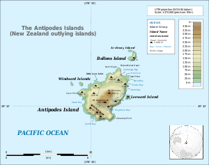
Bollons Island (49°38′42″S 178°49′09″E / 49.645°S 178.819167°E) is a small island of the Antipodes Islands Group with an area of 2 km2 (0.77 sq mi). The island group is part of New Zealand.
History
The island is named after John Bollons, Master of the New Zealand Marine Department vessels, NZGSS Hinemoa and SS Tutanekai.
Important Bird Area
The island is part of the Antipodes Islands Important Bird Area (IBA), identified as such by BirdLife International because of the significance of the group as a breeding site for several species of seabirds.[1]
See also
- Composite Antarctic Gazetteer
- New Zealand Subantarctic Islands
- List of Antarctic and subantarctic islands#List of subantarctic islands
- List of islands of New Zealand
- SCAR
- Territorial claims in Antarctica
Further reading
- Taylor, Rowley, (2006) Straight Through from London, the Antipodes and Bounty Islands, New Zealand.Christchurch: Heritage Expeditions New Zealand Ltd. ISBN 0-473-10650-7.
References
- ^ BirdLife International. (2012). Important Bird Areas factsheet: Antipodes Islands. Downloaded from "Archived copy". Archived from the original on 2007-07-10. Retrieved 2013-04-19.
{{cite web}}: Unknown parameter|deadurl=ignored (|url-status=suggested) (help)CS1 maint: archived copy as title (link) on 2012-01-27.
