
Burr Pond State Park
| Burr Pond State Park | |
|---|---|
 | |
 Location in Connecticut  Burr Pond State Park (the United States) | |
| Location | Torrington, Connecticut, United States |
| Coordinates | 41°52′09″N 73°05′52″W / 41.86917°N 73.09778°W[1] |
| Area | 438 acres (177 ha)[2] |
| Elevation | 988 ft (301 m)[1] |
| Designation | Connecticut state park |
| Established | 1949 |
| Administrator | Connecticut Department of Energy and Environmental Protection |
| Website | Burr Pond State Park |
Burr Pond State Park is a public recreation area covering 438 acres (177 ha) adjacent to Paugnut State Forest in the town of Torrington, Connecticut. The state park surrounds Burr Pond, an 85-acre (34 ha),[3] man-made body of water with facilities for swimming, boating, and fishing. It is managed by the Connecticut Department of Energy and Environmental Protection.[4]
History[edit]
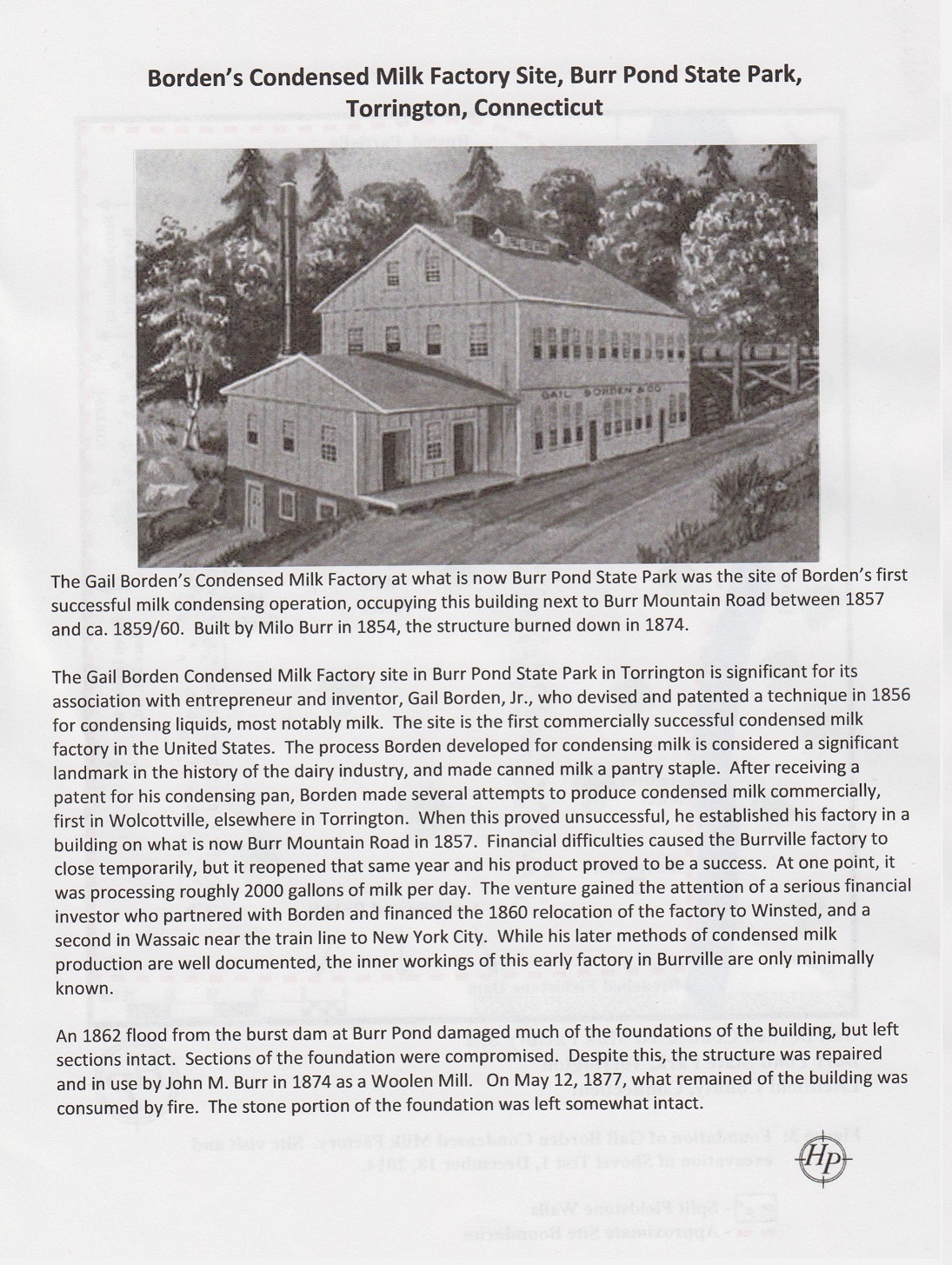
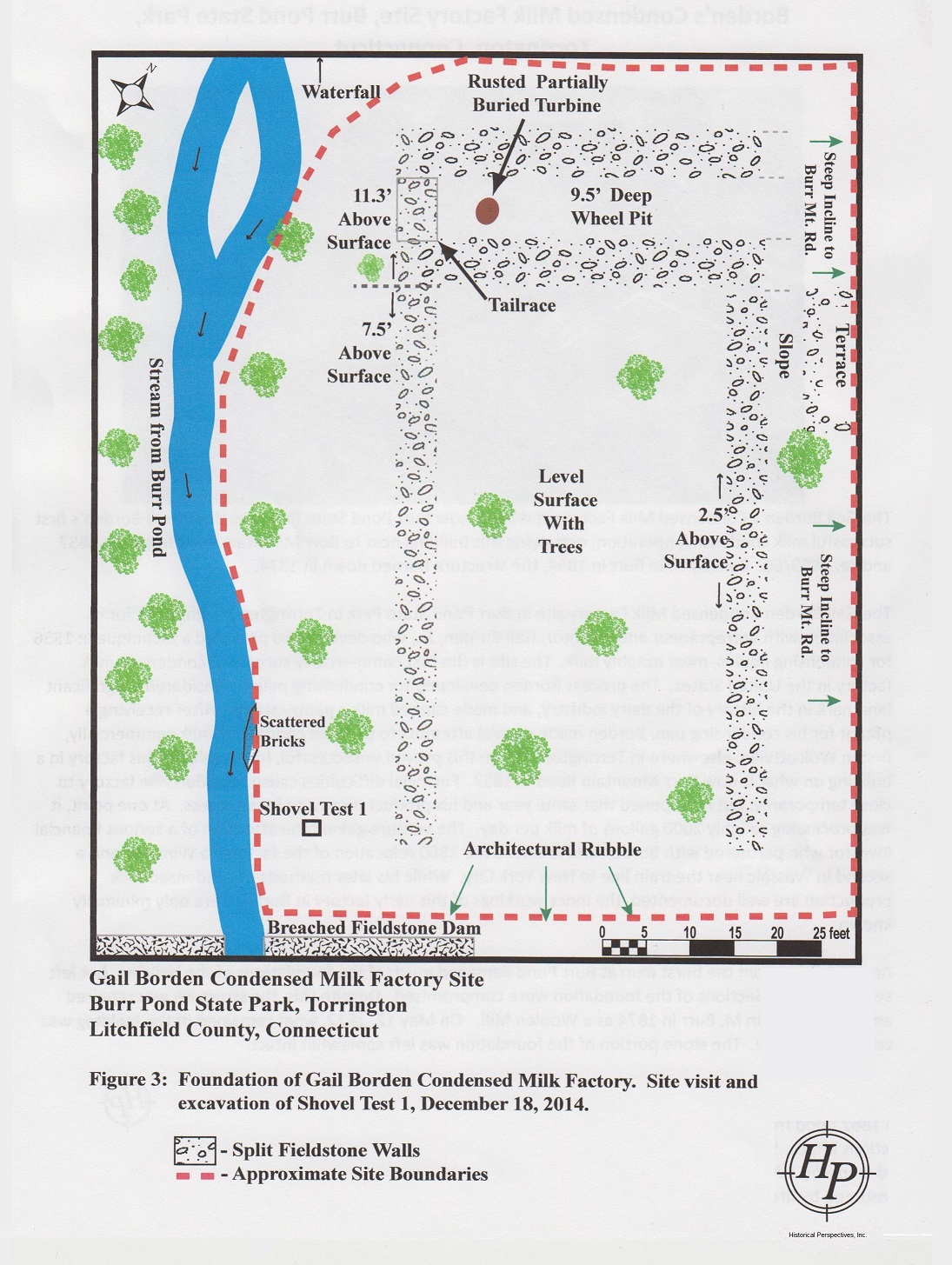
Burr Pond was created in 1851 when Milo Burr dammed several streams to create a source for power generation. The waterpower was used to operate a tannery and three sawmills.[4] One of Burr's industrial buildings was used from 1857 to 1861 by Gail Borden as his first commercially successful condensed milk factory. The building burned down in 1877; the remains of its stone foundations can be seen off Burr Mountain Road.[5][6] Signage identifies the spot.[7]
Burr Pond and the area around it were once part of Paugnut State Forest.[8] The acreage was transferred to the State Parks Division and became a state park in 1949.[4]
Activities and amenities[edit]
Burr Pond has several small inlets and islands, a rocky shore, and deep drop-offs in several places. Its maximum depth is only 13 feet (4.0 m). Fish species present include largemouth bass, chain pickerel, black crappie, yellow perch, bluegill, pumpkinseed, and brown bullhead.
The blue-blazed Walcott Trail 2.5-mile-long (4.0 km) loop goes around the pond.[8] The 2-mile-long (3.2 km) John Muir Trail across Paugnut State Forest connects the park with Sunnybrook State Park.[9]
A swimming beach, picnic areas, concession stand, and boat rentals are offered seasonally.[10] A trailered boat launch is located at the pond's north end.[11]
References[edit]
- ^ a b "Burr Pond State Park". Geographic Names Information System. United States Geological Survey, United States Department of the Interior.
- ^ "Appendix A: List of State Parks and Forests" (PDF). State Parks and Forests: Funding. Staff Findings and Recommendations. Connecticut General Assembly. January 23, 2014. p. A-1. Retrieved March 20, 2014.
- ^ "Burr Pond" (PDF). Connecticut Department of Energy and Environmental Protection. September 2011. Retrieved October 24, 2017.
- ^ a b c "Burr Pond State Park". State Parks and Forests. Connecticut Department of Energy and Environmental Protection. May 2017. Retrieved October 24, 2017.
- ^ "Borden's Condensed Milk Factory Site". Historical Perspectives, Inc. Retrieved July 1, 2015.
- ^ "Borden's Condensed Milk Factory Site Plan". Historical Perspectives, Inc. Retrieved July 1, 2015.
- ^ "World's First Condensed Milk Factory". The Historical Marker Database. Retrieved July 1, 2015.
- ^ a b "Clues for Paugnut State Forest". Connecticut State Forests Seedling Letterbox Series. Connecticut Department of Energy and Environmental Protection. July 7, 2016. Retrieved July 13, 2016.
- ^ "Paugnut State Forest: John Muir Trail" (PDF). Connecticut Bureau of Outdoor Recreation, State Parks Division. 2008. Retrieved July 1, 2015.
- ^ "Canoe & Kayak Rental at Burr Pond, Lake Waramaug, and Squantz Pond State Parks". Connecticut Department of Energy and Environmental Protection. Retrieved July 1, 2015.
- ^ "Burr Pond Boat Launch". Connecticut Department of Energy and Environmental Protection. June 1, 2017. Retrieved October 24, 2017.
External links[edit]
- Burr Pond State Park Connecticut Department of Energy and Environmental Protection
- Burr Pond State Park Map Connecticut Department of Energy and Environmental Protection