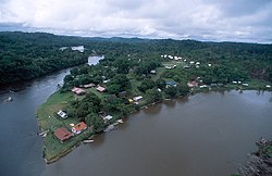
Camopi (river)
Appearance
| Camopi | |
|---|---|
 | |
 | |
| Physical characteristics | |
| Source | |
| • location | French Guiana |
| Mouth | |
• location | Oyapock |
| Length | 244 km (152 mi) |
The Camopi is a 244 km long river in French Guiana.[1] It rises in the south of the country, flowing northeast until it reaches the river Oyapock near the town of Camopi, on the border with Brazil.
References
