
Chicago station (CTA Red Line)
Chicago 800N 0E/0W | |||||||||||||||||||||||||||||||||||||||||||||||||||||||||||||||
|---|---|---|---|---|---|---|---|---|---|---|---|---|---|---|---|---|---|---|---|---|---|---|---|---|---|---|---|---|---|---|---|---|---|---|---|---|---|---|---|---|---|---|---|---|---|---|---|---|---|---|---|---|---|---|---|---|---|---|---|---|---|---|---|
| Chicago 'L' rapid transit station | |||||||||||||||||||||||||||||||||||||||||||||||||||||||||||||||
 | |||||||||||||||||||||||||||||||||||||||||||||||||||||||||||||||
| General information | |||||||||||||||||||||||||||||||||||||||||||||||||||||||||||||||
| Location | 800 North State Street Chicago, Illinois 60654 | ||||||||||||||||||||||||||||||||||||||||||||||||||||||||||||||
| Coordinates | 41°53′48″N 87°37′42″W / 41.896679°N 87.6282°W | ||||||||||||||||||||||||||||||||||||||||||||||||||||||||||||||
| Owned by | City of Chicago | ||||||||||||||||||||||||||||||||||||||||||||||||||||||||||||||
| Line(s) | State Street subway | ||||||||||||||||||||||||||||||||||||||||||||||||||||||||||||||
| Platforms | 2 side platforms | ||||||||||||||||||||||||||||||||||||||||||||||||||||||||||||||
| Tracks | 2 | ||||||||||||||||||||||||||||||||||||||||||||||||||||||||||||||
| Construction | |||||||||||||||||||||||||||||||||||||||||||||||||||||||||||||||
| Structure type | Subway | ||||||||||||||||||||||||||||||||||||||||||||||||||||||||||||||
| Accessible | Yes | ||||||||||||||||||||||||||||||||||||||||||||||||||||||||||||||
| History | |||||||||||||||||||||||||||||||||||||||||||||||||||||||||||||||
| Opened | October 17, 1943 | ||||||||||||||||||||||||||||||||||||||||||||||||||||||||||||||
| Rebuilt | 1999–2001 (station renovation) | ||||||||||||||||||||||||||||||||||||||||||||||||||||||||||||||
| Passengers | |||||||||||||||||||||||||||||||||||||||||||||||||||||||||||||||
| 2022 | 2,079,126[1] | ||||||||||||||||||||||||||||||||||||||||||||||||||||||||||||||
| Services | |||||||||||||||||||||||||||||||||||||||||||||||||||||||||||||||
| |||||||||||||||||||||||||||||||||||||||||||||||||||||||||||||||
| |||||||||||||||||||||||||||||||||||||||||||||||||||||||||||||||
| Location | |||||||||||||||||||||||||||||||||||||||||||||||||||||||||||||||
 | |||||||||||||||||||||||||||||||||||||||||||||||||||||||||||||||
Chicago, (Chicago/State in station announcements) is an "L" station on the CTA's Red Line. It serves a significant portion of the Near North Side and Streeterville neighborhoods. With over 5.25 million overall boardings in 2014, it is the busiest station on the Red Line north of the Loop.[2]
Location[edit]
The second stop on the Red Line north of the Chicago River, Chicago station lies in the central portion of the Near North Side. Specifically, it is located underneath the intersection of State Street and Chicago Avenue.[3] It is three blocks west of the northern section of the Magnificent Mile; the Chicago Water Tower is located on that strip at the intersection of Chicago and Michigan Avenues. It is also the closest 'L' station to the John Hancock Center, Holy Name Cathedral, the Rush Street entertainment district, and the downtown campus of Loyola University Chicago. The Chicago campus of the Moody Bible Institute is also nearby.
History[edit]
The Chicago station opened on October 17, 1943, as part of the State Street subway,[4] which forms the central portion of what is now the Red Line between North/Clybourn and Roosevelt stations.
During the 1950s, the CTA implemented skip-stop service throughout the 'L' system. Under this service pattern, Chicago was designated as AB along with all other downtown stations (on the Red Line, those stops south of Clark/Division and north of Cermak–Chinatown were given AB designations).[5] As a result, all trains stopped at these stations. The skip-stop service was ended due to budget cuts in the 1990s.
Renovation[edit]
From 1999 until 2001, Chicago underwent renovation and refurbishment, in line with other stations of the State Street subway. Work included making the station accessible to people with disabilities, with new elevators, redone flooring, retiling, and increased mezzanine space.[6][7]
Unlike most State Street Subway stations, Chicago uses a side platform configuration with two tracks, also used at Grand/State and North/Clybourn. There are entrances from street level at all corners of the intersection of North State Street and Chicago Avenue. One level below street level is a mezzanine containing fare controls and turnstiles, and the platforms are located beneath the mezzanine.
Bus connections[edit]
- 36 Broadway
- 66 Chicago (Owl Service)
See also[edit]
References[edit]
- ^ "Annual Ridership Report – Calendar Year 2022" (PDF). Chicago Transit Authority, Ridership Analysis and Reporting. February 2, 2023. Retrieved June 9, 2023.
- ^ "Monthly Ridership Report – December 2014" (PDF). Chicago Transit Authority Ridership Analysis and Reporting. March 5, 2015. Archived from the original (PDF) on April 13, 2015. Retrieved April 25, 2015.
- ^ Chicago (Red Line subway station) CTA Retrieved July 29, 2010
- ^ Shinnick, William (October 17, 1943). "Chicago Underground--A Subway at Last!". Chicago Daily Tribune. p. C1.
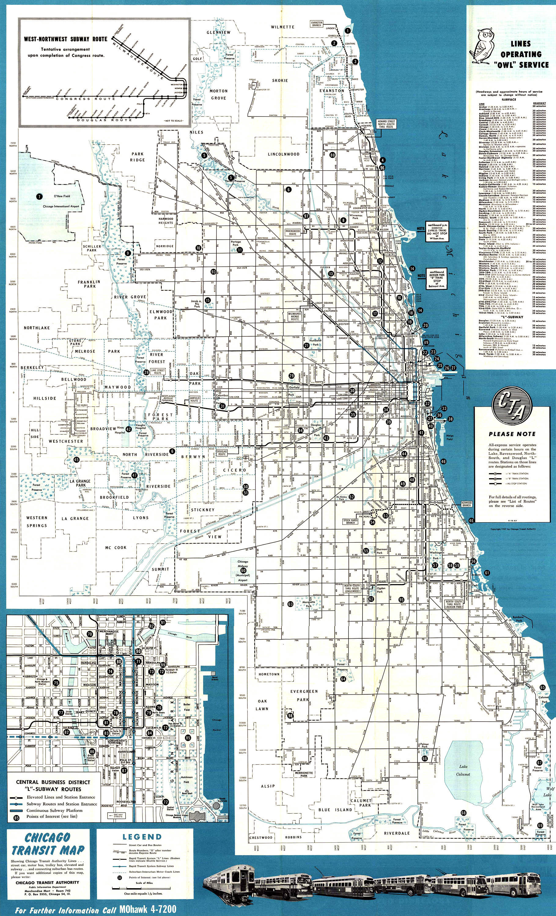
- ^ "1957 Chicago 'L' system map". Chicago-L.org. Retrieved February 8, 2011.
- ^ Chicago/State Chicago-L.org Retrieved July 29, 2010
- ^ "CTA Press Release - MAYOR DALEY UNVEILS NEW CTA CHICAGO-STATE SUBWAY STATION - CTA".
External links[edit]
- Chicago/State Station Page on the CTA official site
- Chicago Avenue entrance from Google Maps Street View