Chignahuapan
Appearance
Chignahuapan Municipality | |
|---|---|
Municipality and town | |
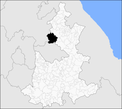
 Location of the municipality in Puebla | |
| Country | |
| State | Puebla |
| Time zone | UTC-6 (Central Standard Time) |
| • Summer (DST) | UTC-5 (Central Daylight Time) |
| Website | http://www.chignahuapan.gob.mx/ |
Chignahuapan Municipality (Spanish pronunciation: [tʃiɣnaˈwapan] ) is a town and municipality in Puebla in south-eastern Mexico.[1]
The municipality is the location of many touristic places very well known all over the state such as the Basilica of the Immaculate Conception which is the biggest figure of the virgin Mary in Latin America,also Las Aguas Termales De Chignahuapan. The main economy of Chignahuapan is making Christmas baubles. [2]
The BUAP has a Regional Section there.
References
- ^ "-". Enciclopedia de los Municipios de México. Instituto Nacional para el Federalismo y el Desarrollo Municipal. Retrieved January 4, 2010.
- ^ Medina, Imelda. "Tuesday, Nov 27, Mexico". Reuters. Reuters. Retrieved 15 December 2011.


