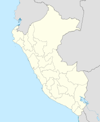
Coronel FAP Alfredo Mendívil Duarte Airport
Appearance
Coronel FAP Alfredo Mendívil Duarte Airport | |||||||||||
|---|---|---|---|---|---|---|---|---|---|---|---|
| Summary | |||||||||||
| Airport type | Public | ||||||||||
| Operator | CORPAC S.A. | ||||||||||
| Location | Ayacucho | ||||||||||
| Elevation AMSL | 8,917 ft / 2,718 m | ||||||||||
| Coordinates | 13°09′17″S 74°12′15″W / 13.15472°S 74.20417°W | ||||||||||
 | |||||||||||
| Runways | |||||||||||
| |||||||||||
Coronel FAP Alfredo Mendívil Duarte Airport (IATA: AYP, ICAO: SPHO) is an airport serving Ayacucho, Peru. It is run by CORPAC S.A. (Corporación Peruana de Aeropuertos y Aviación Comercial S.A.), a government-run organization that oversees the management of Peruvian airports. It is the main airport of the Ayacucho Region. It is served by three airlines.
Airlines and destinations
| Airlines | Destinations |
|---|---|
| LAN Perú | Lima |
| LC Perú | Lima |
External links

