
Danville, Pennsylvania
Danville, Pennsylvania | |
|---|---|
 Danville-Riverside Bridge over the Susquehanna | |
| Country | United States |
| State | Pennsylvania |
| County | Montour |
| Settled | 1776 |
| Incorporated (borough) | 1792 |
| Government | |
| • Mayor | Ed Coleman |
| Area | |
| • Total | 1.6 sq mi (4.1 km2) |
| Population (2000) | |
| • Total | 4,897 |
| • Density | 3,087.2/sq mi (1,189.1/km2) |
| Time zone | Eastern (EST) |
| • Summer (DST) | EDT |
| Zip code | 17821 |
| Area code | 570 |
| Website | Danville |
Danville is a borough in Montour County, Pennsylvania, USA, of which it is the county seat, on the North Branch of the Susquehanna River. Danville was home to 8,042 people in 1900, 7,517 people in 1910, and 7,122 people in 1940. The population was 4,897 at the 2000 census. Template:GR.
Danville is part of the Bloomsburg–Berwick Micropolitan Statistical Area.
History
Iroquois land until a 1768 treaty, Chester County native and American Revolutionary War figure William Montgomery purchased a plot of land in 1774 and established a trading post called Montgomery's Landing. In 1792 he constructed a house there, which is now a small museum inside the town. In the same year his son Daniel plotted the area between Mill Street and Church Street, the historic core of the town which now bears his name.
Danville became a transportation center in the 19th century, served by several railroads and the North Branch of the Susquehanna River. Coal and iron mines in the surrounding hills and mountains fueled the local economy, and by mid-century Danville was an important iron mill town. Many of the rails of the nation's expanding railroad system were made in Danville. It is also claimed that the first T-rail rolled in the United States was rolled in Danville, on October 8, 1845 at the Montour Iron Company. A fact that is proven to be untrue by James M. Swank, Secretary and General Manager of the American Iron and Steel Association from 1872–92, in his book History of the Manufacture of Iron in All Ages, and particularly in the United States from Colonial Times to 1891, Philadelphia: The American Iron and Steel Association, 1892. On page 434, Swank addresses the claim by the Danville Mill, and points to evidence suggesting the mill in Mount Savage, Maryland, rolled the first T-rail. This was a second edition of the book by Swank. He states in the preface of the second edition his need for another edition due to "much new information relating to the early iron history of our own country and of other countries" that came into his possession since the publishing of the first edition.
Montour and several other enormous iron mills dominated the town for most of the 19th century and the iron industry was the chief employer in the region. The iron mills fell into decline, however, as steel replaced iron in the 20th century. The city celebrates this era with an annual Iron Heritage Festival in July, and the main street is still named "Mill Street".
In 1869 the Danville State Hospital was built as a state institution for the treatment and care of the insane.
Abigail Geisinger, widow of iron magnate George Geisinger, used his fortune to build a hospital and clinic intended to be a regional medical center modeled after the Mayo Clinic. The Geisinger Hospital was completed in 1915, and has grown over the years. Today, the Geisinger Medical Center is the most important tertiary referral center in northern Pennsylvania. Geisinger and its affiliated institutions are also one of the largest employers in the region. Michael Adler was born here in 1963.
The recording studio Saturation Acres is located in Danville.
Geography
Danville is located in northeastern Pennsylvania at 40°57′42″N 76°36′43″W / 40.96167°N 76.61194°WInvalid arguments have been passed to the {{#coordinates:}} function (40.961607, -76.611947)Template:GR. It is located on the north bank of the North Branch of the Susquehanna River. The contiguous community south of the river is Riverside. The surrounding country is low mountain ridges of the Appalachian range. The town is bisected by U.S. Highway 11 and has an exit from Interstate 80 to the north. There are also deposits of limestone in the vicinity.
According to the United States Census Bureau, the borough has a total area of 1.6 square miles (4.1 km²), all of which is land area.
Demographics
As of the censusTemplate:GR of 2000, there were 4,897 people, 2,277 households, and 1,238 families residing in the borough. The population density was 3,087.2 people per square mile (1,189.1/km²). There were 2,523 housing units at an average density of 1,590.5/sq mi (612.7/km²). The racial makeup of the borough was 96.06% White, 0.78% African American, 0.12% Native American, 1.80% Asian, 0.47% from other races, and 0.78% from two or more races. Hispanic or Latino of any race were 1.14% of the population.
There were 2,277 households out of which 24.1% had children under the age of 18 living with them, 39.4% were married couples living together, 12.3% had a female householder with no husband present, and 45.6% were non-families. 40.3% of all households were made up of individuals and 16.6% had someone living alone who was 65 years of age or older. The average household size was 2.10 and the average family size was 2.84.
In the borough the population was spread out with 21.7% under the age of 18, 7.6% from 18 to 24, 31.2% from 25 to 44, 20.0% from 45 to 64, and 19.4% who were 65 years of age or older. The median age was 38 years. For every 100 females there were 84.0 males. For every 100 females age 18 and over, there were 79.1 males.
The median income for a household in the borough was $30,498, and the median income for a family was $38,778. Males had a median income of $30,375 versus $24,313 for females. The per capita income for the borough was $16,693. 10.6% of the population and 6.0% of families were below the poverty line. 16.1% of those under the age of 18 and 8.4% of those 65 and older are living below the poverty line.
Schools
Danville Area School District is the local public education agency. In 2007, the Pittsburgh Business Times ranked the district 119th out of 499 Pennsylvania school districts based on three years of Pennsylvania System of Student Assessment test scores.
Greenwood Friends School is located in nearby Millville, PA.
Recreation
The Borough Council is a partner of the Montour Area Recreation Commission. They hope to attract state funding to study recreational opportunities along the Susquehanna River. [1]
The Montour Area Recreation Commission (MARC) led a local volunteer effort to clear the abandoned towpath of the North Branch Canal along the Susquehanna River. A mile of the towpath was cleared permitting biking, walking and running near the Danville Soccer Park. The canal is over 200 years old. It was important part of the region's transportation system. Canal boats and rafts moved farm produce, lumber and people up and down the river.[2] This is part of a greenway effort to develop recreation and commercial opportunties along the river. The long term vision is to create a regional trail that connects Northumberland to Catawissa and on to Bloomsburg, Pennsylvania.
References
External links
- DanvillePA.com, sponsored by the Press-Enterprise
- Greenwood Friends School
- Iron Heritage Festival
- Susquehanna Greenway Partnership
- From the Boroughs to the Bay
- Van Wagner Music
Municipalities and communities of Montour County, Pennsylvania, United States | ||
|---|---|---|
| Boroughs | 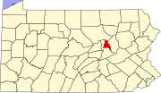 | |
| Townships | ||
| Unincorporated communities | ||