
File:Shark Bay.svg

Size of this PNG preview of this SVG file: 532 × 600 pixels. Other resolutions: 213 × 240 pixels | 426 × 480 pixels | 681 × 768 pixels | 908 × 1,024 pixels | 1,816 × 2,048 pixels | 1,197 × 1,350 pixels.
Original file (SVG file, nominally 1,197 × 1,350 pixels, file size: 365 KB)
| This is a file from the Wikimedia Commons. Information from its description page there is shown below. Commons is a freely licensed media file repository. You can help. |
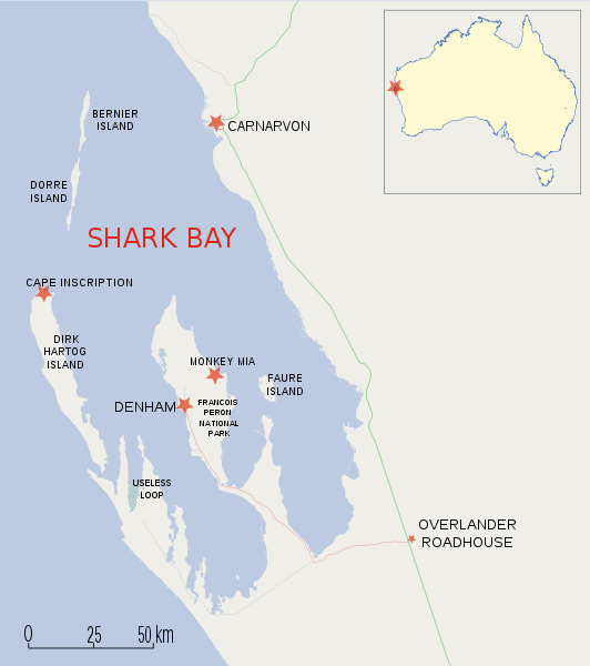
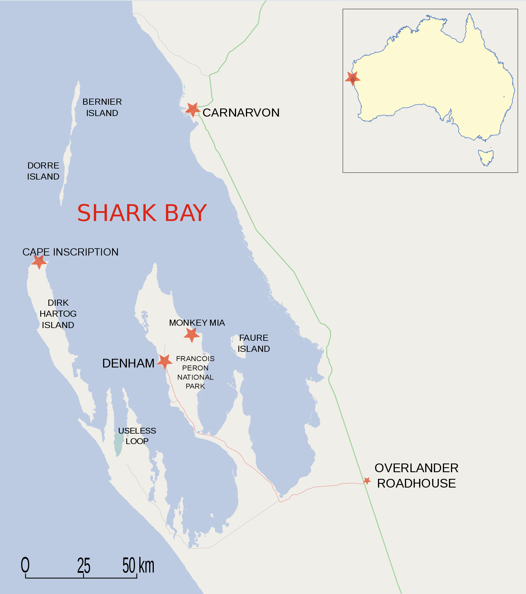
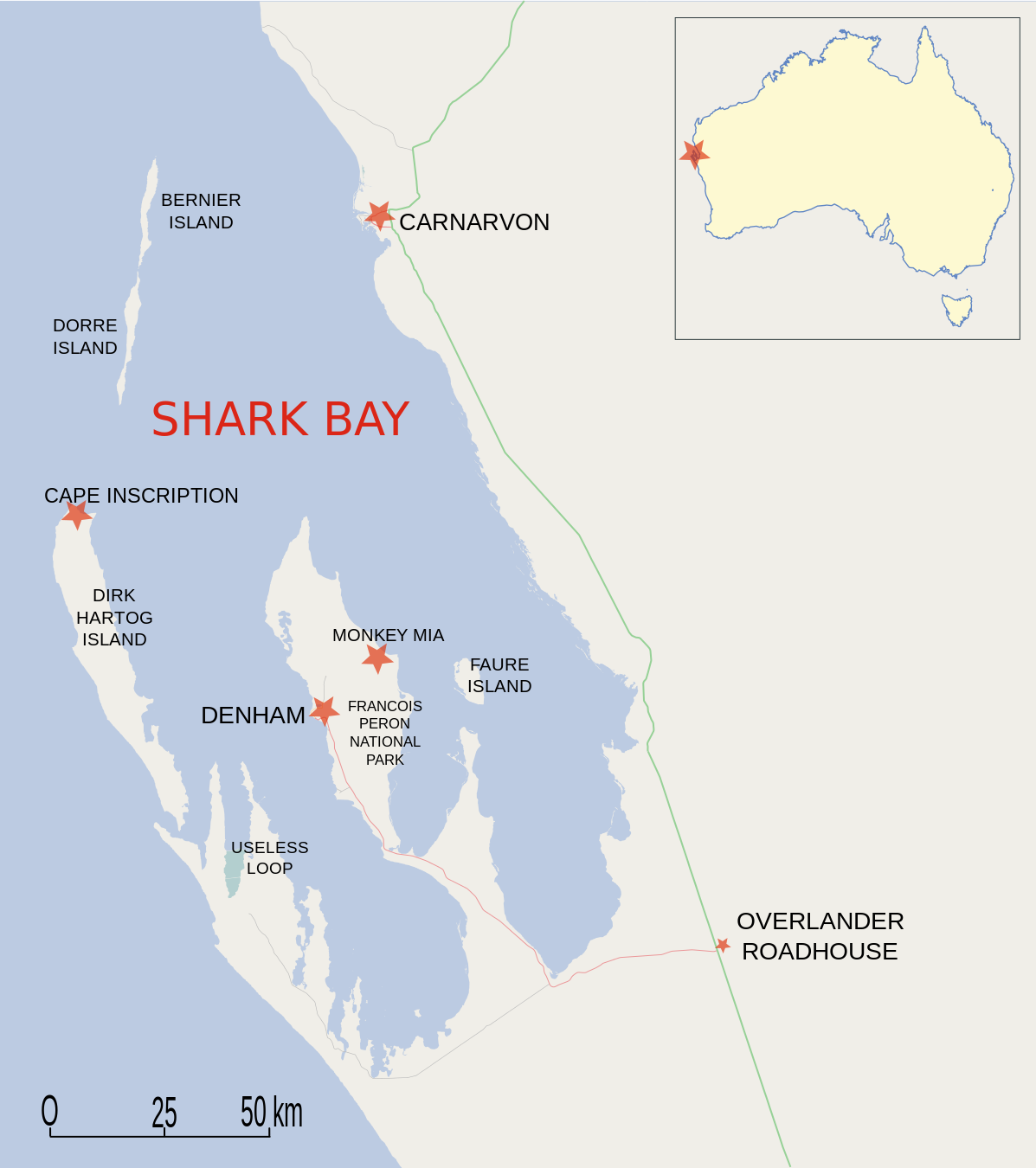
Map of Shark Bay region, Western Australia
| Description |
This map was created from OpenStreetMap project data, collected by the community. This map may be incomplete, and may contain errors. Don't rely solely on it for navigation. |
| Date | (see file history) |
| Source | openstreetmap.org |
| Creator |
OpenStreetMap contributors |
| Permission (Reusing this file) |
OpenStreetMap data and maps are licensed under the Creative Commons Attribution-ShareAlike 2.0 license (CC-BY-SA 2.0). This file is licensed under the Creative Commons Attribution-Share Alike 2.0 Generic license.
|
| Georeferencing | If inappropriate please set warp_status = skip to hide. |
 |
File:Shark Bay fr.svg
Carte en français |
File history
Click on a date/time to view the file as it appeared at that time.
| Date/Time | Thumbnail | Dimensions | User | Comment | |
|---|---|---|---|---|---|
| current | 04:53, 14 August 2009 | | 1,197 × 1,350 (365 KB) | Moondyne | smaller, AU locator map |
| 15:39, 27 November 2008 |  | 4,519 × 5,094 (334 KB) | Moondyne | rejig the boundaries, again. license unchanged | |
| 15:31, 27 November 2008 |  | 3,821 × 4,323 (334 KB) | Moondyne | rejig the boundaries, license unchanged | |
| 15:22, 27 November 2008 |  | 1,688 × 2,224 (334 KB) | Moondyne | labelled, license unchanged | |
| 14:27, 27 November 2008 |  | 1,688 × 2,224 (331 KB) | Moondyne | Map of Shark Bay region, Western Australia {{openstreetmap}} <!--{{ImageUpload|basic}}--> |
File usage
The following pages on the English Wikipedia use this file (pages on other projects are not listed):
Global file usage
The following other wikis use this file:
- Usage on arz.wikipedia.org
- Usage on bg.wikipedia.org
- Usage on ca.wikipedia.org
- Usage on ceb.wikipedia.org
- Usage on cs.wikipedia.org
- Usage on da.wikipedia.org
- Usage on de.wikipedia.org
- Usage on en.wikivoyage.org
- Usage on es.wikipedia.org
- Usage on fr.wikipedia.org
- Usage on fr.wikivoyage.org
- Usage on gl.wikipedia.org
- Usage on he.wikipedia.org
- Usage on hr.wikipedia.org
- Usage on hu.wikipedia.org
- Usage on it.wikipedia.org
- Usage on ja.wikipedia.org
- Usage on ka.wikipedia.org
- Usage on lt.wikipedia.org
- Usage on ms.wikipedia.org
- Usage on nl.wikipedia.org
View more global usage of this file.