
File:2010 Central Canada earthquake skake map.png
Size of this preview: 489 × 600 pixels. Other resolutions: 196 × 240 pixels | 391 × 480 pixels | 815 × 1,000 pixels.
Original file (815 × 1,000 pixels, file size: 1.27 MB, MIME type: image/png)
| This is a file from the Wikimedia Commons. Information from its description page there is shown below. Commons is a freely licensed media file repository. You can help. |
Summary
| Description |
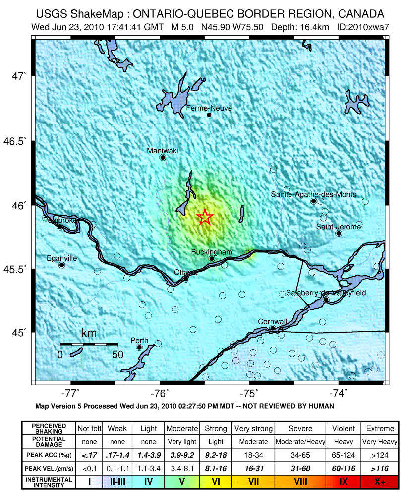
English: 2010 Central Canada earthquake intensity map. |
|||
| Date | ||||
| Source | United States Geologic Survey | |||
| Author | USGS | |||
| Permission (Reusing this file) |
|
File history
Click on a date/time to view the file as it appeared at that time.
| Date/Time | Thumbnail | Dimensions | User | Comment | |
|---|---|---|---|---|---|
| current | 21:54, 23 June 2010 | | 815 × 1,000 (1.27 MB) | The Cosmonaut | == Summary == {{Information |Description={{en|1=2010 Central Canada earthquake intensity map.}} |Source=[http://earthquake.usgs.gov/earthquakes/shakemap/global/shake/2010xwa7/ United States Geologic Survey] |Author= |
File usage
The following pages on the English Wikipedia use this file (pages on other projects are not listed):
Global file usage
The following other wikis use this file:
- Usage on fr.wikipedia.org
- Usage on ja.wikipedia.org