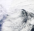
File:2011 Winter Storm along the U.S. East Coast.jpg

Size of this preview: 659 × 599 pixels. Other resolutions: 264 × 240 pixels | 528 × 480 pixels | 844 × 768 pixels | 1,126 × 1,024 pixels | 2,251 × 2,048 pixels | 4,552 × 4,141 pixels.
Original file (4,552 × 4,141 pixels, file size: 6.56 MB, MIME type: image/jpeg)
File history
Click on a date/time to view the file as it appeared at that time.
| Date/Time | Thumbnail | Dimensions | User | Comment | |
|---|---|---|---|---|---|
| current | 01:05, 14 April 2021 |  | 4,552 × 4,141 (6.56 MB) | HikingHurricane | crop |
| 12:28, 13 January 2011 |  | 4,552 × 9,104 (6.12 MB) | Originalwana | {{Information |Description={{en|1=Photo-like image of a winter storm along the U.S. East Coast. The storm had a distinctive comma shape—reminiscent of a hurricane—that forms when air circles around a low-[[:Category:Press |
File usage
The following pages on the English Wikipedia use this file (pages on other projects are not listed):


