
File:Abbottabad NWFP.svg

Size of this PNG preview of this SVG file: 516 × 600 pixels. Other resolutions: 206 × 240 pixels | 413 × 480 pixels | 661 × 768 pixels | 881 × 1,024 pixels | 1,762 × 2,048 pixels | 925 × 1,075 pixels.
Original file (SVG file, nominally 925 × 1,075 pixels, file size: 30 KB)
| This is a file from the Wikimedia Commons. Information from its description page there is shown below. Commons is a freely licensed media file repository. You can help. |
Summary
| Description |
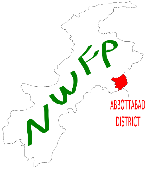
English: Map showing position of Abbottabad district (highlighted in red), within the North West Frontier Province of Pakistan, created file using Inkscape, based on maps from http://www.nwfp.gov.pk/. |
| Date | |
| Source | Own work |
| Author | Pahari_Sahib (talk) (Uploads) |
Licensing
I, the copyright holder of this work, hereby publish it under the following license:

|
Permission is granted to copy, distribute and/or modify this document under the terms of the GNU Free Documentation License, Version 1.2 or any later version published by the Free Software Foundation; with no Invariant Sections, no Front-Cover Texts, and no Back-Cover Texts. A copy of the license is included in the section entitled GNU Free Documentation License. |
| This file is licensed under the Creative Commons Attribution-Share Alike 3.0 Unported license. | ||
| ||
| This licensing tag was added to this file as part of the GFDL licensing update. |

|
This media file is uncategorized.
Please help improve this media file by adding it to one or more categories, so it may be associated with related media files (how?), and so that it can be more easily found.
Please notify the uploader with {{subst:Please link images|File:Abbottabad NWFP.svg}} ~~~~ |
File history
Click on a date/time to view the file as it appeared at that time.
| Date/Time | Thumbnail | Dimensions | User | Comment | |
|---|---|---|---|---|---|
| current | 07:03, 17 April 2007 | | 925 × 1,075 (30 KB) | Pahari Sahib | Map showing the position of Abbottabad District (highlighted in red), within theNorth West Frontier Province of Pakistan, created file using Inkscape, based on maps from http://www.nwfp.gov.pk/ |
| 22:10, 15 April 2007 |  | 925 × 1,075 (21 KB) | Pahari Sahib | Map showing position of Abbottabad district (highlighted in red), within the North West Frontier Province of Pakistan, created file using Inkscape, based on maps from http://www.nwfp.gov.pk/. |
File usage
The following pages on the English Wikipedia use this file (pages on other projects are not listed):