
File:Aegean Sea map bathymetry-fr.jpg
Size of this preview: 493 × 600 pixels. Other resolutions: 197 × 240 pixels | 395 × 480 pixels | 631 × 768 pixels | 842 × 1,024 pixels | 1,684 × 2,048 pixels | 3,744 × 4,554 pixels.
Original file (3,744 × 4,554 pixels, file size: 4.22 MB, MIME type: image/jpeg)
| This is a file from the Wikimedia Commons. Information from its description page there is shown below. Commons is a freely licensed media file repository. You can help. |
Summary
| Camera location | | View this and other nearby images on: OpenStreetMap |
|---|
| Description |
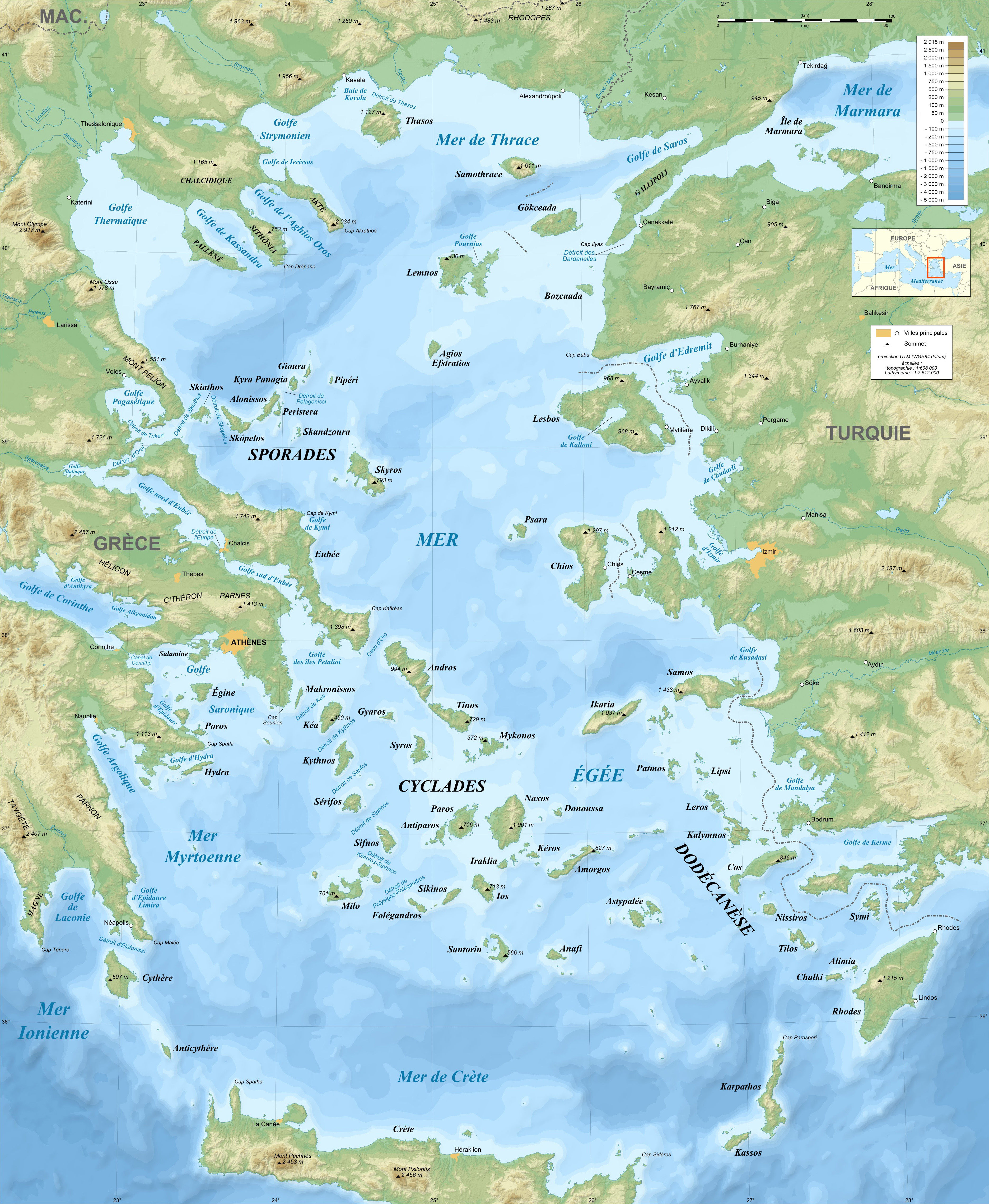
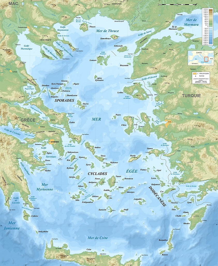
Français : Carte bathymétrique en français de la Mer Égée, Mer Méditerranée.
|
||
| Date | November 2007 (modified September 2008) | ||
| Source |
Own work ;
|
||
| Author | Eric Gaba (Sting - fr:Sting) | ||
| Permission (Reusing this file) |
|
||
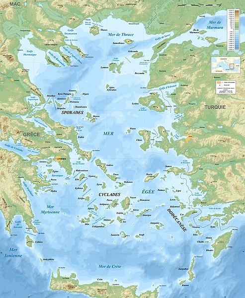
| Other versions |
[]
Same map but full SVG and without relief and bathymetry:
|


Licensing
I, the copyright holder of this work, hereby publish it under the following licenses:

|
Permission is granted to copy, distribute and/or modify this document under the terms of the GNU Free Documentation License, Version 1.2 or any later version published by the Free Software Foundation; with no Invariant Sections, no Front-Cover Texts, and no Back-Cover Texts. A copy of the license is included in the section entitled GNU Free Documentation License. |
This file is licensed under the Creative Commons Attribution-Share Alike 4.0 International, 3.0 Unported, 2.5 Generic, 2.0 Generic and 1.0 Generic license.
- You are free:
- to share – to copy, distribute and transmit the work
- to remix – to adapt the work
- Under the following conditions:
- attribution – You must give appropriate credit, provide a link to the license, and indicate if changes were made. You may do so in any reasonable manner, but not in any way that suggests the licensor endorses you or your use.
- share alike – If you remix, transform, or build upon the material, you must distribute your contributions under the same or compatible license as the original.
You may select the license of your choice.
File history
Click on a date/time to view the file as it appeared at that time.
| Date/Time | Thumbnail | Dimensions | User | Comment | |
|---|---|---|---|---|---|
| current | 21:52, 17 July 2010 | | 3,744 × 4,554 (4.22 MB) | Sting | Color profile |
| 19:10, 15 June 2010 |  | 3,744 × 4,554 (5.36 MB) | Ras67 | cropped | |
| 19:35, 12 February 2009 |  | 3,750 × 4,560 (2.74 MB) | Sting | == Summary == {{Location|38|00|00|N|25|00|00|E|scale:3000000}} <br/> {{Information |Description={{en|Bathymetric map in French of the Aegean Sea, Mediterranean Sea.}} {{fr|Carte bathymétrique en français de la [[:Category:Aegean |
File usage
No pages on the English Wikipedia use this file (pages on other projects are not listed).
Global file usage
The following other wikis use this file:
- Usage on an.wikipedia.org
- Usage on bg.wikipedia.org
- Usage on bs.wikipedia.org
- Usage on cs.wikipedia.org
- Usage on de.wikipedia.org
- Usage on en.wikiversity.org
- Usage on eo.wikipedia.org
- Usage on es.wikipedia.org
- Usage on fr.wikipedia.org
- Usage on fr.wiktionary.org
- Usage on gl.wikipedia.org
- Usage on hyw.wikipedia.org
- Usage on id.wikibooks.org
- Usage on ilo.wikipedia.org
- Usage on incubator.wikimedia.org
- Usage on ja.wikipedia.org
View more global usage of this file.