
File:CAK-Diagram.png
Size of this preview: 390 × 599 pixels. Other resolutions: 156 × 240 pixels | 312 × 480 pixels | 774 × 1,189 pixels.
Original file (774 × 1,189 pixels, file size: 166 KB, MIME type: image/png)
| This is a file from the Wikimedia Commons. Information from its description page there is shown below. Commons is a freely licensed media file repository. You can help. |
| Description |
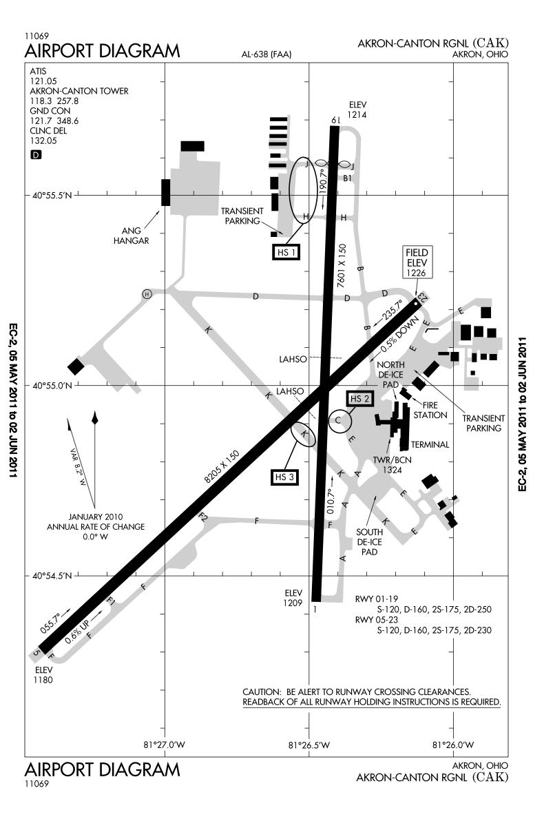
English: Higher resolution of the FAA diagram of en:Akron-Canton Regional Airport (CAK) in Akron, Ohio, converted from PDF format to PNG format by me, User:IanManka. Original PDF file
Note: this URL changes monthly; the airport article should contain a link to the current FAA diagram. Produced by the National Aeronautical Charting Office (NACO), a department of the en:Federal Aviation Administration (FAA). |
|||
| Date | ||||
| Source | http://aeronav.faa.gov/d-tpp/1105/00638AD.PDF | |||
| Author | en:Federal Aviation Administration | |||
| Permission (Reusing this file) |
|
|||
| Other versions | File:CAK-Diagram.gif |

File history
Click on a date/time to view the file as it appeared at that time.
| Date/Time | Thumbnail | Dimensions | User | Comment | |
|---|---|---|---|---|---|
| current | 05:02, 9 May 2011 | | 774 × 1,189 (166 KB) | IanManka | {{Information |Description ={{en|1=Higher resolution of the FAA diagram of en:Akron-Canton Regional Airport (CAK) in Akron, Ohio, converted from PDF format to PNG format by me, User:IanManka. [http://aeronav.faa.gov/d-tpp/1105/00638AD.PDF Orig |
File usage
The following pages on the English Wikipedia use this file (pages on other projects are not listed):
Global file usage
The following other wikis use this file:
- Usage on arz.wikipedia.org
- Usage on ceb.wikipedia.org
- Usage on de.wikipedia.org
- Usage on en.wikivoyage.org
- Usage on fa.wikipedia.org
- Usage on fi.wikipedia.org
- Usage on fr.wikipedia.org
- Usage on it.wikivoyage.org
- Usage on ja.wikipedia.org
- Usage on mr.wikipedia.org
- Usage on no.wikipedia.org
- Usage on tg.wikipedia.org
- Usage on ur.wikipedia.org
- Usage on www.wikidata.org