
File:Cauca Topographic 2.png

Size of this preview: 613 × 600 pixels. Other resolutions: 245 × 240 pixels | 491 × 480 pixels | 785 × 768 pixels | 1,047 × 1,024 pixels | 1,814 × 1,775 pixels.
Original file (1,814 × 1,775 pixels, file size: 7.7 MB, MIME type: image/png)
| This is a file from the Wikimedia Commons. Information from its description page there is shown below. Commons is a freely licensed media file repository. You can help. |
Summary
| Description |
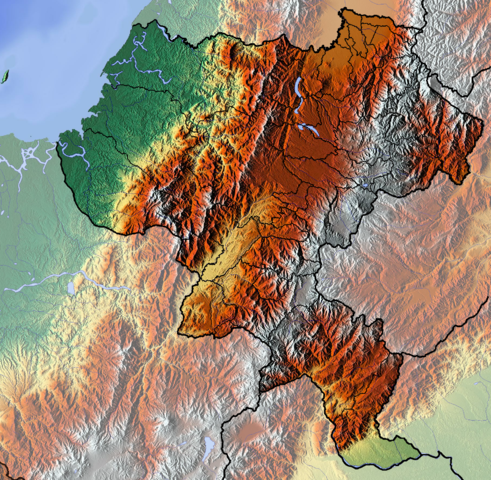
Français : Cauca dept |
| Date | |
| Source | Own work (backgroung : http://www.maps-for-free.com) |
| Author | Dr Brains |
Licensing
I, the copyright holder of this work, hereby publish it under the following licenses:

|
Permission is granted to copy, distribute and/or modify this document under the terms of the GNU Free Documentation License, Version 1.2 only as published by the Free Software Foundation; with no Invariant Sections, no Front-Cover Texts, and no Back-Cover Texts. A copy of the license is included in the section entitled GNU Free Documentation License. | 1.2 only |
|
|
Permission is granted to copy, distribute and/or modify this document under the terms of the GNU Free Documentation License, Version 1.3 or any later version published by the Free Software Foundation; with no Invariant Sections, no Front-Cover Texts, and no Back-Cover Texts. A copy of the license is included in the section entitled GNU Free Documentation License.
|
You may select the license of your choice.
File history
Click on a date/time to view the file as it appeared at that time.
| Date/Time | Thumbnail | Dimensions | User | Comment | |
|---|---|---|---|---|---|
| current | 13:29, 9 June 2012 | | 1,814 × 1,775 (7.7 MB) | Dr Brains |
File usage
The following pages on the English Wikipedia use this file (pages on other projects are not listed):
Global file usage
The following other wikis use this file:
- Usage on avk.wikipedia.org
- Usage on bg.wikipedia.org
- Usage on es.wikipedia.org
- Cauca (Colombia)
- Morro del Tulcán
- Macizo Colombiano
- Isla Gorgona
- Volcán Puracé
- Volcán Sotará
- Wikiproyecto:Ilustración/Taller de Cartografía/Realizaciones/América del Sur
- Embalse Salvajina
- Plantilla:Mapa de localización de Cauca
- Bota Caucana
- Cadena volcánica de los Coconucos
- Volcán Petacas
- Serranía del Pinche
- Usage on fa.wikipedia.org
- Usage on fr.wikipedia.org
- Cauca (département)
- Popayán
- Nevado del Huila
- Inzá
- Almaguer
- Argelia (Cauca)
- Balboa (Cauca)
- Bolívar (Cauca)
- Buenos Aires (Cauca)
- Cajibío
- Caldono
- Caloto
- Corinto (Cauca)
- El Tambo (Cauca)
- Florencia (Cauca)
- Guapi
- Jambaló
- La Sierra (Cauca)
- La Vega (Cauca)
- López de Micay
- Mercaderes
- Miranda (Cauca)
- Morales (Cauca)
- Padilla (Cauca)
- Páez (Cauca)
- Patía
- Piamonte
- Piendamó
- Puerto Tejada
- Puracé (Cauca)
- Rosas (Cauca)
- San Sebastián (Cauca)
- Santander de Quilichao
View more global usage of this file.