
File:Cyclone Zoe 27 dec 2002 2255Z.jpg

Size of this preview: 463 × 599 pixels. Other resolutions: 185 × 240 pixels | 371 × 480 pixels | 593 × 768 pixels | 791 × 1,024 pixels | 1,582 × 2,048 pixels | 6,800 × 8,800 pixels.
Original file (6,800 × 8,800 pixels, file size: 7.24 MB, MIME type: image/jpeg)
| This is a file from the Wikimedia Commons. Information from its description page there is shown below. Commons is a freely licensed media file repository. You can help. |
| Warning | The original file is very high-resolution. It might not load properly or could cause your browser to freeze when opened at full size. |
|---|
Summary
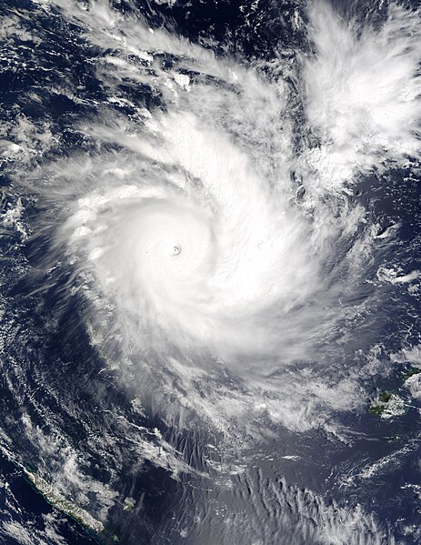
| Description | In this Moderate Resolution Imaging Spectroradiometer (MODIS) image from December 27, Tropical Cyclone Zoe was located near 11.8S and 170.2E. The storm was moving west-southwest at about 7 knots but was expected to gradually turn to the southwest. Maximum 10-minute average winds near the center are estimated at 125 knots and are expected to increase to 135 knots in the next 12 hours. | |||||
| Date | ||||||
| Source | http://visibleearth.nasa.gov/view_rec.php?id=4854 | |||||
| Author | Jeff Schmaltz, MODIS Rapid Response Team, NASA/GSFC | |||||
| Permission (Reusing this file) |
|
|||||
| Other versions | Image:Tropical Cyclone Zoe 2002.jpg |

File history
Click on a date/time to view the file as it appeared at that time.
| Date/Time | Thumbnail | Dimensions | User | Comment | |
|---|---|---|---|---|---|
| current | 06:55, 16 November 2006 | | 6,800 × 8,800 (7.24 MB) | Good kitty | == Summary == {{Information |Description=In this Moderate Resolution Imaging Spectroradiometer (MODIS) image from December 27, Tropical Cyclone Zoe was located near 11.8S and 170.2E. The storm was moving west-southwest at about 7 knots but was expected to |
File usage
The following pages on the English Wikipedia use this file (pages on other projects are not listed):
Global file usage
The following other wikis use this file:
- Usage on ca.wikipedia.org
- Usage on es.wikipedia.org
- Usage on fr.wikipedia.org
- Usage on id.wikipedia.org
- Usage on ko.wikipedia.org
- Usage on ms.wikipedia.org
- Usage on pt.wikipedia.org
- Usage on ru.wikipedia.org
- Usage on th.wikipedia.org
- Usage on uk.wikipedia.org
- Usage on vi.wikipedia.org
- Usage on www.wikidata.org